Five Fast Facts about the Mayacamas Mountains

.

The Mayacamas Mountain Range is a short mountain range—stretching just 52 miles (80 km) in a northwest-southeasterly direction—but it is very well-known to wine lovers as the range that forms the dividing line between Napa and Sonoma counties. However, the famous Napa/Sonoma divide only accounts for about 30 miles of the famous mountains’ total length of 52 miles. Read on to see what else makes the Mayacamas Mountains famous!

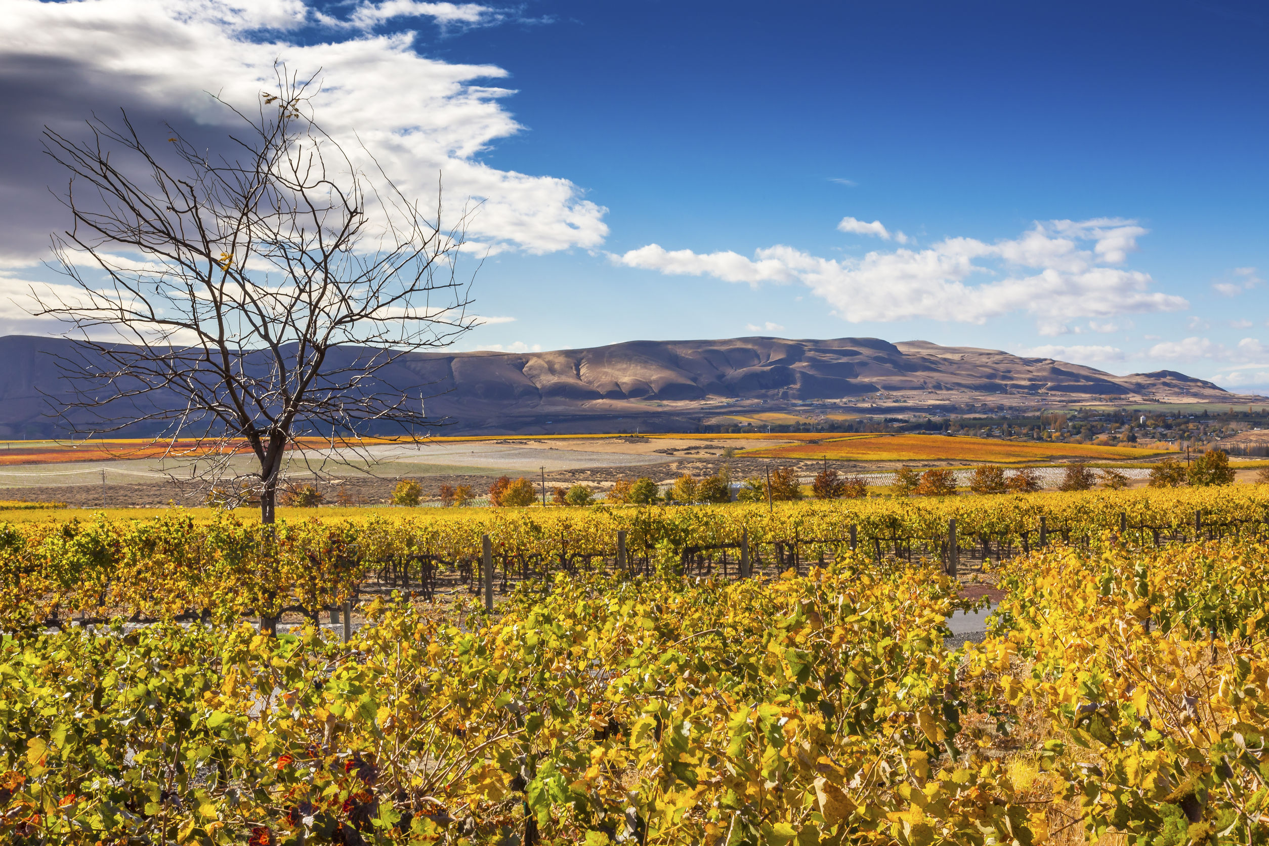
#1—Cobb Mountain: Cobb Mountain, peaking at 4,720 feet (1,439 m), is the highest point in the Mayacamas Range. It lies just outside of the town of Cobb in Lake County. The mountain is located outside of the range of any Lake County AVAs, but is only about five miles south of the southern edge of the Red Hills—Lake County AVA (and the larger Clear Lake AVA). This portion of the Mayacamas is responsible for the rolling hills and high-elevation vineyards of the Red Hills-Lake County AVA, which range in elevation from 1,600 to 2,500 feet (490 to 760 m) above sea level.

.

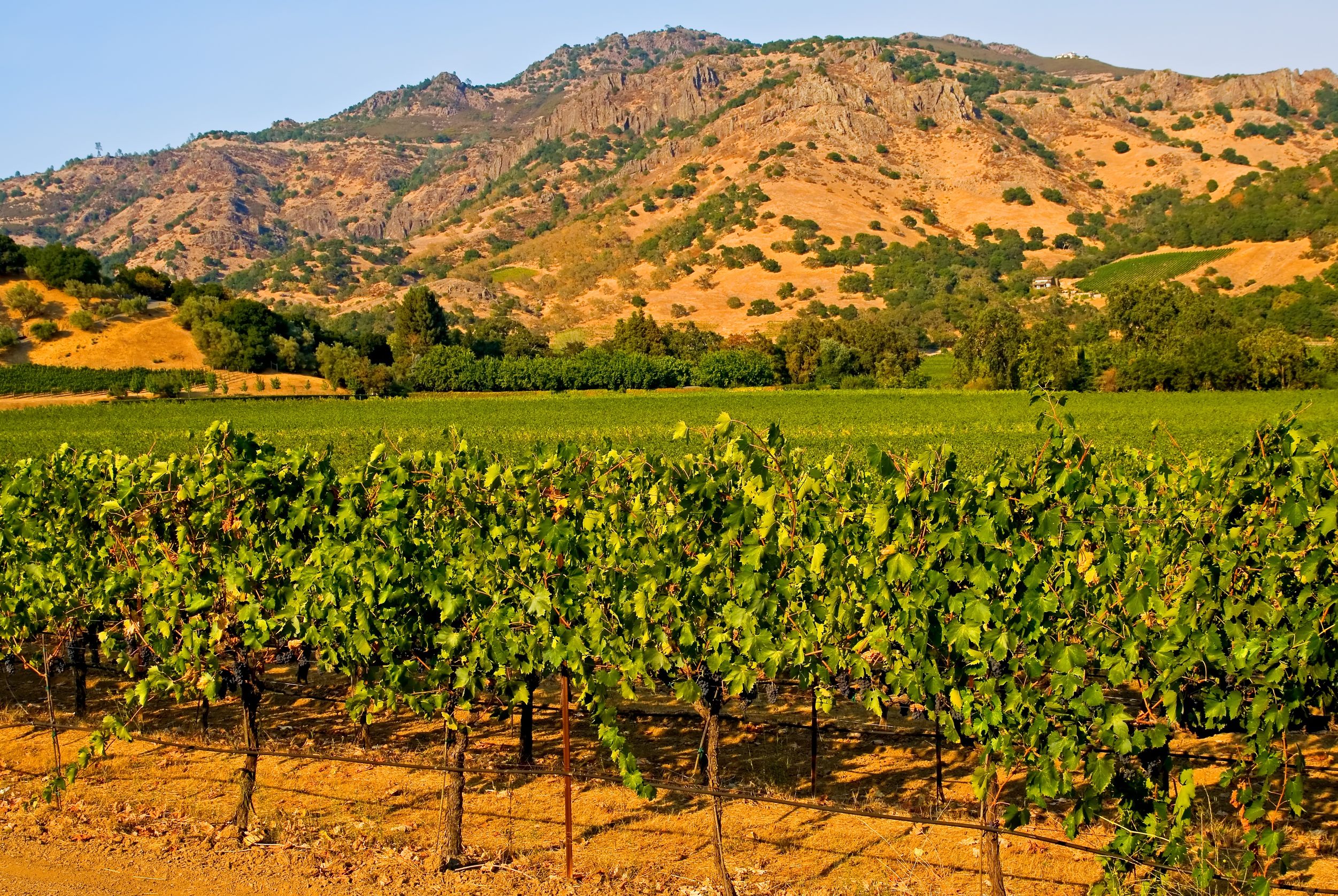
#2—Mount Saint Helena: Mount Saint Helena, located at the boundaries of Napa, Sonoma, and Lake Counties, has five peaks that form something of an “M” shape. One of those peaks is located within the Knights Valley AVA and is the highest point in Sonoma County. The second-tallest peak—at 4,200 feet (1,280 m)—is the highest point in Napa County (this peak is located within the Napa Valley AVA but to the north of the Calistoga AVA). Both of these peaks may be reached via hiking trails located within Robert Louis Stevenson State Park.

#3—The Napa River: Mount Saint Helena is the source of the Napa River. The Napa River runs for 50 miles (88 km) from the southeast slope of Mount Saint Helena through the revered Napa AVAs of Calistoga, St. Helena, Rutherford, Oakville, Yountville, and Oak Knoll (as well as the city of Napa) before heading towards the Napa/Sonoma Marsh. The last 17 miles of the Napa River take it from the Trancas Steet bridge in Napa to the city of Vallejo through the Carquinez Straits—a long estuary bordering and empyting into San Pablo Bay.

.

#4—The Watersheds: Towards their northern edge—just before the Mayacamas Mountains blend into the Mendocino Range in Mendocino County, the Mayacamas Mountains form the boundary between the watershed of the Russian River (as it flows south into Sonoma) and Clear Lake. This is one of the differentiating factors between the terroir of Mendocino County and Lake County.

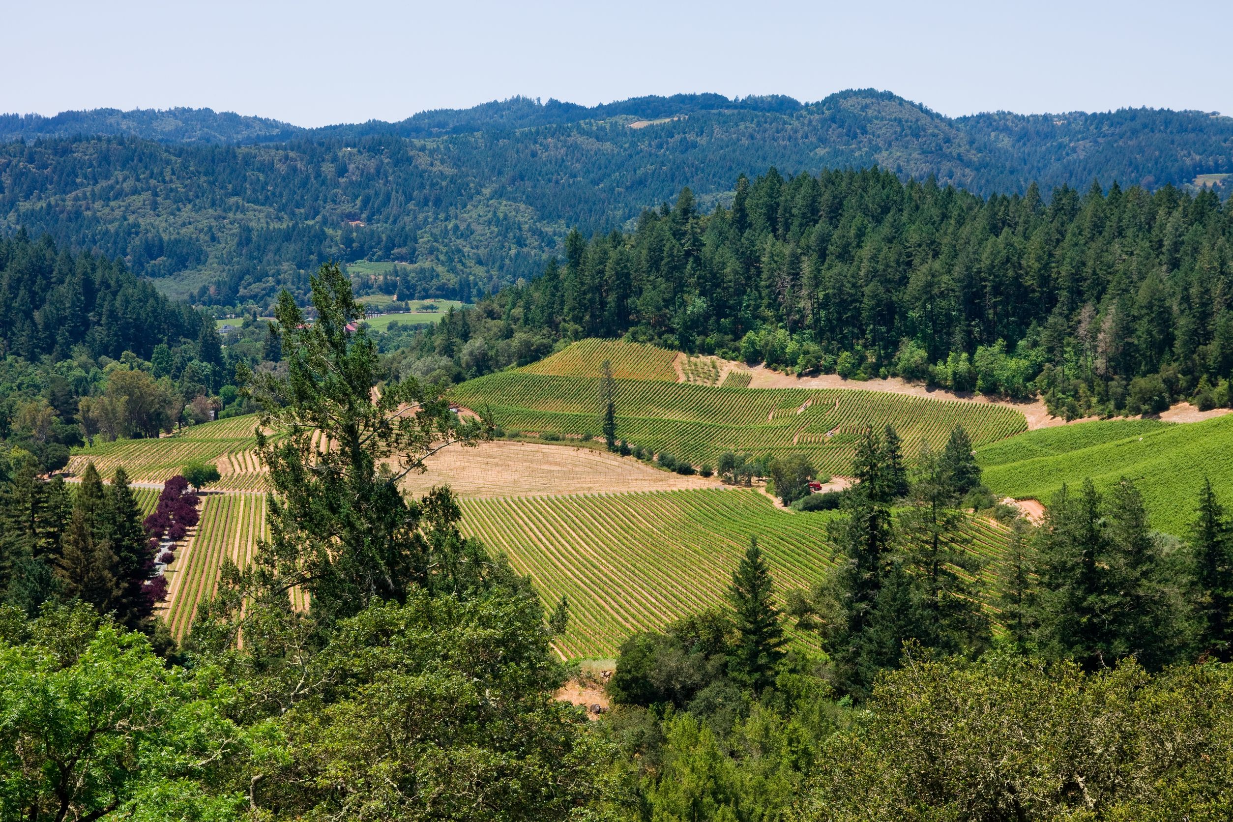
#5—The Howell Mountains: The famous Howell Mountain AVA (of Napa Valley) is actually located within a mountain range known as the Howell Mountains. The Howell Mountains blend into the Mayacamas in northern Napa just north/west of their famous namesake mountain and namesake AVA. The Howell Mountains begin just north of San Pablo Bay and form the border between the Suisun Valley (of Solano County) AVA and the Napa Valley AVA. From there, they extend to the north/northwest for about 40 miles (64 km), after which they blend into the Mayacamas. The Howell Mountains are also known as the Mt. George Range; the southern portions of the mountains are often referred to as the Napa Hills.

.

In terms of mountainous parentage, the Mayacamas Mountains are considered to be part of the Coast Ranges of California—which (in addition to the Mayacamas Range) include the Vaca Mountains, the Mendocino Range, and the Santa Cruz Mountains. The Coast Ranges of California span for over 400 miles (640 km) from Humboldt County, through Mendocino, onward through Napa and Sonoma—all the way south to Santa Barbara County.

References/for more information:

The Bubbly Professor is “Miss Jane” Nickles of Austin, Texas… missjane@prodigy.net

The Melancholy Seewinkel (the Outer Limits)

Lighthouse on Lake Neusiedl

For the title (and the rest of this article) to make any sense at all, I need to start this post with a quote, lifted directly from the website of the Neusiedllersee DAC Association  (or, as they like to call it, the Verein Neusiedlersee DAC):

“The Neusiedlersee vineyards are situated along the eastern shore of the Neusiedl Lake, ranging from the hills of the county capital, across the large wine growing community of Gols, over the flats of the Heideboden, down in to the melancholical Seewinkel.”

For those of us who are not too well-versed in the wines of Austria, let me break this down a bit:

  • Neusiedlersee is a politcal region as well as a DAC wine region located in the Austrian state of Burgenland.
  • One of the main geological features of the area is its namesake Lake Neusiedl—a large endorheic (closed-basin) lake that extends in a long, narrow swath between the  wine regions of Neusiedlersee and Leithaberg, and crosses over into the neighboring country of Hungary on its southern edge. The large water surface of the lake heats up in the summer and releases stored heat at night. Certain areas planted around the lake are conducive to the growth of botrytis, and the area is known for both dry, red wines and sweet, botrytis-affected white wines.
  • The vineyards of the Neusiedlersee are planted across an area of about 15 miles (25 km)—when measured from north to south—and are centered around the east side of the lake and extend slightly eastward from there.

  • Gols (located near the northern tip of the lake) is a town of about 4,000 people that is largely centered on wine in addition to lake-centric tourism (bird watching, lake excursions).
  • The Heideboden is a flat area located just to the south of Gols.  The name Heideboden does not show up on the wine map (or most other maps) as it is not an actual town or appellation, but is the traditional name given to the area between Lake Neusiedlersee and the Danube River.  Heideboden covers parts of both modern-day Austria and Hungary.
  • Seewinkel (which means lake [see] corner [winkel]) is the area located at the southern end of Lake Neusiedlersee, closest to the Hungarian border. The area has a unique microclimate due to the presence of many small lakes and ponds, and is well-known as a producer of botrytis-affected sweet white wines.  While grape varieties vary, Welschriesling is the focus. (The famous sweet-wine-producing town of Rust is just to the west, on the opposite side of the lake.)

Neusiedler See-Seewinkel National Park

The area of Seewinkle is well-known for its natural beauty which includes—in addition to vineyards—the Neusiedlersee-Seewinkle National Park that serves as both a park and a nature reserve. The park is unique in that it stretches across the borders of Austria and Hungary, where it is known as Fertő-Hanság National Park. Combined, these areas encompass the Fertö / Neusiedlersee Cultural Landscape, a UNESCO World Heritage Site since 2001. The park is famously home to over 340 species of birds and a landscape of sand dunes, reed beds, and shallow salt water ponds. Year-round activities include guided hikes, cycling, canoe excursions, photography classes and llama walks (yes, llama walks).

Once I figured out all of the above, I was still obsessed with why Seewinkel is described as “melancholy.” Hours of research failed to provide a solid answer, but I did find a few references to a certain melancholy beauty of the sunsets and a melancholy edge to the folk dances and traditional music of the area.

Reed Belt landscape in Neusiedler See-Seewinkel National Park

It certainly isn’t the wine!

Note:  The Neusiedlersee DAC is approved for Zweigelt-based red wines only, so the sweet wines of the area are labeled with Burgenland as their region-of-origin.

References/for more information:

The Bubbly Professor is “Miss Jane” Nickles of Austin, Texas… missjane@prodigy.net

The Outer Limits is my series of appreciative posts about small, obscure, or out-of-the-way wine regions.


The Hunt for Red Mountain

.

During the years when I taught my Professional Wine Studies class at a local culinary school, I had a standard set of wines I used on tasting days. Red wine day always included Napa Cabernet, Argentine Malbec, Australian Shiraz, Sonoma Zinfandel, Oregon Pinot Noir, and Washington State Merlot. You have to admit, it’s a pretty good flight for wine newbies.

My favorite wine to use for the Washington Merlot was from Fidélitas Wines. Fidélitas Red Mountain Merlot, to be exact. I adore that wine—rich with aromas of blackberry, strawberry, pomegranate, and dried cherry—with a hint of sage, tobacco, and rose petal as well. It was a great example of Merlot for my students, and remains one of my favorite red wines.

.

When my husband and I decided to embark on a road trip after this year’s SWE Conference in Portland, we had the idea to drive through Oregon and Washington, down through Idaho, and onward to Salt Lake City (we’d fly home from there). This was a great trip, and we planned some wonderful experiences, including hiking though the Columbia Gorge, seeing the actual “rocks” of Milton-Freewater, lunching at the Crossings Winery in Idaho, and visiting Shohone Falls. But I had one main goal—to seek out and find the source of my long-time favorite Washington State wine: Fidélitas Red Mountain Merlot.

And thus began our hunt for Red Mountain.

To begin the hunt, we headed west from our hotel in Richland assisted by our handy rental car GPS device and anticipating an easy 15-mile drive. The first part of the drive was a bit confusing, as we rolled past suburban strip malls and then a whole lotta nothing…but then we experienced one of those magical wine touring moments where the lazy highway looped around a corner and suddenly we were at the bank of the Yakima River staring at an expanse of vineyards as far as the eye could see.

Obviously, we were getting warmer and when the GPS squawked at us to take a sharp turn off the highway and head north, we obliged. It wasn’t long until madame GPS told us get off the highway altogether and make a sharp U-turn and turn south, followed by a quick turn east. It made sense, seeing we were surrounded by vineyards, but the very road we had been ordered to take soon turned to gravel, and then to dirt, and then to cinder blocks, abandoned tractors, and  a few discarded washing machines. This was not the place.

Without beating the story to a pulp, let’s just say that after four more tries, we gave up on GPS and switched to iPad navigation—with the same results. After giving that a try, we decided to just drive around and see what we could find. We soon found a street called Antinori Drive. Well…what wine lover could resist a drive down Antinori Drive?

.

We didn’t know it yet, but we had driven around in circles enough to find ourselves in the heart of the Red Mountain AVA, and as we slow-drove down Antinori Drive we passed Force Majeure Vineyard, Longwinds Canvasback Vineyard, and the Hedges Family Estate. We turned on North Sunset Road and stumbled upon Red Mountain Vintners and the Kiona Ranch at the End of the Road.

We decided to make our way home and opted for more scenery by taking a different road out—and drove directly into the parking lot at Fidélitas Wines’ Red Mountain Tasting Room. Of course, we made an afternoon of it and sampled an array of delicious wines—the Malbec and the Chardonnay were among my favorites—they were almost as good as the Red Mountain Merlot. They had a large map of the Red Mountain AVA on the wall and we were able to figure out where we had been (and how to get home in one piece). We purchased a slew of bottles, enjoyed the amazing view from their back patio, and even ran into some folks from the SWE Conference that had ended just a few days earlier. All in all, it was a pretty good day in wine country.

.

Here are a few fascinating fast facts about the Red Mountain AVA:

  • At just 4,040 acres, Red Mountain is one of the smallest AVAs in Washington State.  Just under 3,000 of these acres are planted to vines.
  • Red Mountain is a sub-appellation of the Yakima Valley AVA (which is itself a sub-appellation of the Columbia Valley AVA).
  • The AVA  has an elevation of 1,410 feet (430 m) at its highest point.
  • The name “Red Mountain” derives from the invasive Cheatgrass that covers parts of the mountain—it turns a reddish color in the summer.
  • The entire AVA is located on the south/southeast slope of Red Mountain (which really looked like more of a hill to me) that faces the Yakima River. This combined with the northerly latitude (46°N) and minimum rainfall (just 7 inches in a typical year) means the area has long days, an extraordinary amount of sunshine during the growing season, and a large diurnal temperature variance.
  • Red Mountain is largely planted to Cabernet Sauvignon, but Syrah, Viognier, Grenache, Mourvèdre, Merlot, Malbec, Petit Verdot, Sangiovese and a smattering of other grapes are seen here as well.
  • In 2002, Quilceda Creek Winery used Cabernet Sauvignon grapes from the Red Mountain and Heaven Hills AVAS to produce the first American wine from outside of California to earn a 100-point score from Robert Parker.  As of this year (2017), Quilceda Creek Winery has produced six wines that have earned “100 Parker Points.”

References/for more information:

The Bubbly Professor is “Miss Jane” Nickles of Austin, Texas… missjane@prodigy.net

In my Mind I’m Going to Porto Santo

.

Porto Santo is a Portuguese island located in the Atlantic Ocean, 27 miles (43 km) northeast of the island of Madeira. It forms the Madeira Archipelago along with the island of Madeira and a small string of islands known as las Ilhas Desertas (literally “the Deserted Islands”).  Porto Santo is a small island, measuring 9 miles (14 km) long and just 5 miles (7.7 km) across.

The earliest record of the history of Porto Santa dates from 1418, when a group of Portuguese ships were (accidently) blown into its sheltered harbor. The ships were in the service of Infante Henrique of Portugal, and had been blown off-course by an intense storm. They named the island Porto Santo (“Holy Harbor”), as their arrival in a sheltered bay during the storm was seen as the result of divine intervention. .

The Ilhéu de Baixo along the unpopulated northern coast

Geologically, the island is divided into two parts—the mountainous northeast, and a relatively flat coastal plain in the southwest, which includes a 4.5 mile-long (7 km) golden sand beach. Laid-back tourism is one of the main industries, and visitors can enjoy hiking, biking, motorbiking, off-roading, windmills, forts, or golf; and may choose to take a two-hour boat ride to Madeira aboard the ferry Lobo Marinh. Waterfront wining and dining may be found in Vila Baleira, the one and only “city” on the island.

History buffs can pay a visit to the Christopher Columbus House Museum and learn that Christopher Colombus was once married to a Portuguese woman and that they lived on Porto Santo for a period of time. Colombus’ wife, Filipa Moniz, unfortunately passed away during childbirth just a few years after their marriage.

Topographical map of the Madeira Archipelago by Bourrichon via Wikimedia Commons

In the 1420s, the Portuguese King sent a group under the command of Captain Bartolomeu Perestrelo to colonize the island. The group planted grapevines and sugar cane, and introduced rabbits to the island. The introduction of rabbits turned out to be not such a good idea, as they rampaged their way across the island and soon dominated the local environment. In a matter of a few (rabbit) generations, they basically ate everything else up.

Another not-so-smart move by these early settlers involved the local Dragon Trees. The valuable sap of the trees, known as “dragon’s blood” is a type of resin used for medicine and dyes. The colony chopped down the trees and literally bled the trees dry to the point that they became extinct on the island. As such, the island lost its original wind protection—and with the help of the ravaging wild rabbits—the area was left rather rugged, wind-blown, and barren. While it certainly has  its own style of natural beauty, the island has never recovered to its original lush state.

Despite the challenges, there is some viticulture on the island of Porto Santo. As Porto Santo is included in the geographic territory of the Madeira DOC, the Madeirense DOC and the VR Terras Madeirenses, these wines may be produced on the island of Porto Santo. Despite the limitations, grapes are a pretty big deal here—agriculture is limited on the island, making grapes, melons, and rabbit the three biggest commodities.

Grapes or wine from Porto Santo may also be sent to the island of Madeira for use in the wines bottled there. There are some obvious logistical challenges to such a project, however—it has been known to happen. For instance, the Madeira Vintners used Listrão and Caraco grapes from Porto Santo in their 2013 vintage. That same year, Porto Santo grower J. Santos produced a sweet white wine from locally grown Listrão as well as an off-dry white wine from the Porto Santo-grown Caracol grapes. You can read reviews of both of these wines on Niklas Jörgensen’s Mad about Madiera blog.

References/for further information:

The Bubbly Professor is “Miss Jane” Nickles of Austin, Texas… missjane@prodigy.net