The Icy Benguela
December 11, 2015 Leave a comment
…
I’ve been curious about the Benguela Current for a while. My original curiosity about the Benguela Current was about the name —how did it get that very cool name? It seems it all begins with Portuguese sailors in the 1500s.
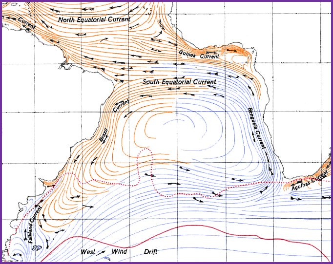
In the Age of Discovery, Portuguese Sailors—known for skill and courage in ocean navigation —often sailed the long and arduous ocean journey around the continent of Africa to Asia. During such voyages, they had to fight against two mighty ocean currents: the icy Benguela current that flowed northward along the coast of Africa while they were trying to sail south; then, after they rounded the Cape of Good Hope, they sailed north while fighting the warm and southward-flowing Agulhas Current. If the journey was successful, they reached Asia and accessed the famed Indian Spice Routes. Such accomplishments helped the Portuguese form their empire, which at various times included parts of Africa, the Middle East, India, South America, and South Asia.
…
The namesake of the Benguela Current (as it is now known) is a city in present-day Angola. The area surrounding Benguela, due to its location near the coast and a well-traversed deep bay, has been a center of commercial trade since ancient times. While there is no written record of the history of the area before the arrival of the Portuguese in 1546, it is believed that the area was formerly known as ombaka, which means, literally, “commercial (or ‘market’) port.” When the Portuguese colonized the area, a town was founded and named São Felipe de Benguela (Saint Philip of Benguela) after King Philip II of Spain and Portugal.
So back to ocean current: the icy Benguela Current flows from the Southern Ocean near Antarctica and moves north along the west coast of Africa. It reaches as far north as Angola (close to the city of Benguela, in case you missed that point) before it turns west and heads to South America. The Benguela Current is part of a large circulating ocean current known as the South Atlantic Ocean gyre. The western edge of the gyre is known as the Brazil Current; the Brazil current flows southward down the coast of Brazil, then turns east and flows across the ocean until it reaches Antarctica. From Cape Point in South Africa (at about 33°), the cold portion of the current known as the Benguela current flows northward along the west coast of Africa to the area around Angola/Benguela (about 16°S).

Cape Agulhas…pick your ocean!
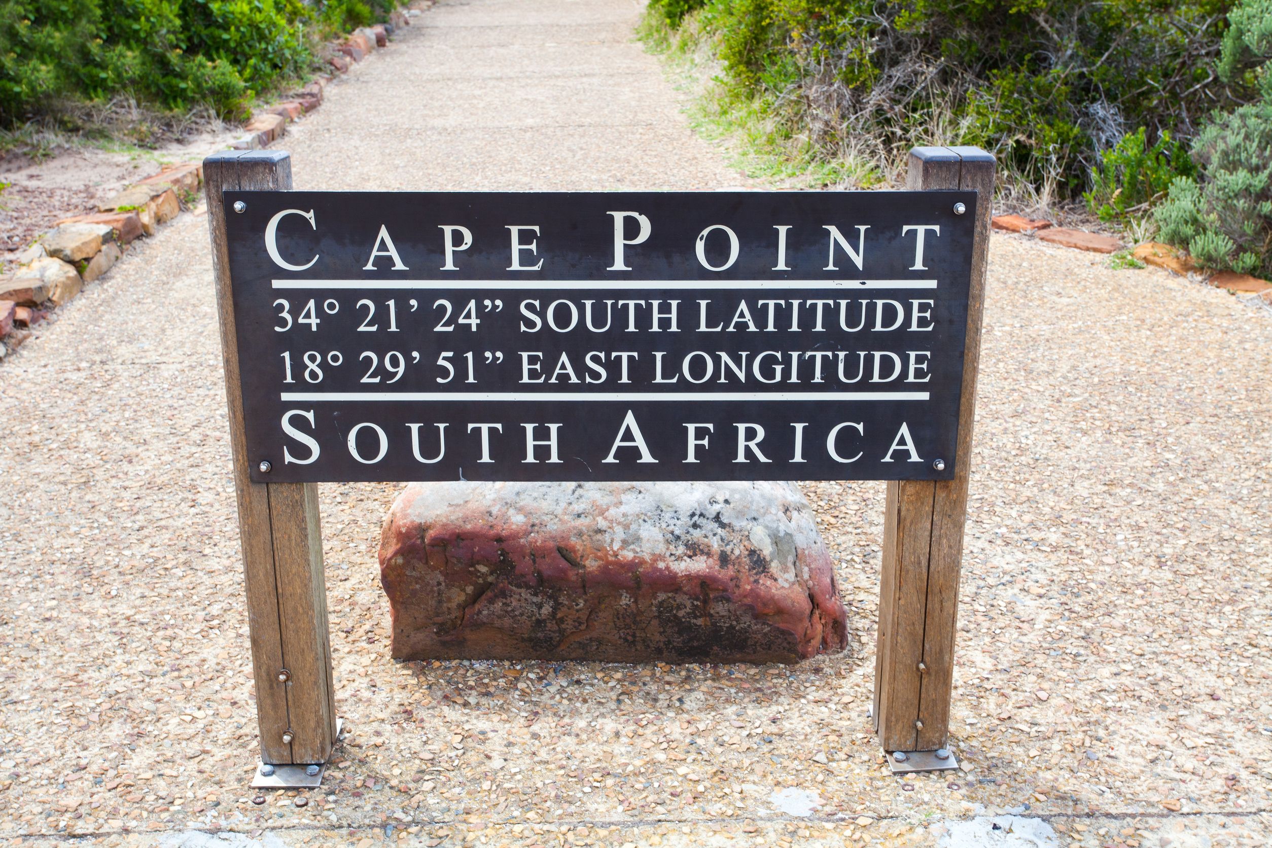
Near Cape Point, where a portion of the cold Benguela Current of the Atlantic meets the warm south- and west-flowing Agulhas Current of the Southern Pacific Ocean, the waters become wild and turbulent. It’s a common practice while on vacation in Cape Town to journey down to Cape Point, take a short hike, get your picture taken by the sign, and stare out to sea at the “place where two oceans meet.” (Hey, I did it.) However, the truth is that the ocean currents actually intermingle for hundreds of miles in either direction—both east and west of Cape Point—and that the “point where two oceans meet” is likely to be anywhere between Cape Point and about 100 miles west at Cape Agulhas (which is actually the southernmost point on the African continent and worth a visit as well).
From the department of I thought this was a wine blog: Good point. All I can say is that my curiosity concerning Benguela Current peaked while studying the wines of South Africa. The winelands of South Africa’s Western Cape are cooled by the moist fog and gentle breezes generated by the Benguela Current, which also generates the not-so-gentle south-easterly wind known as the “Cape Doctor.”

…
Super-sharp students of wine might also have perked up with the mention of Cape Point, which is the former name of the Cape Peninsula wine district; and Cape Agulhas, a wine district located in the Cape South Coast. Cape Peninsula is a small area located on a narrow, rugged area just south of Cape Town and east of Constantia (both wine regions are easily accessed via taxi or tour bus from Cape Town). Cape Peninsula produces snappy, cool-climate white wines and is particularly adept at Sauvignon Blanc. The terroir of Cape Agulhas, about 100 miles down the coast, is also markedly maritime—distinctly cool and breezy—and known for a crisp, snappy style of Sauvignon Blanc, apricot-and-lemon laced Semillon, and a unique cool-climate style of Shiraz.
References:
- http://www.ruf.rice.edu/~feegi/benguela.html
- http://oceancurrents.rsmas.miami.edu/atlantic/benguela.html
- http://www.pbs.org/edens/namib/earth2.htm
- http://www.brest.ird.fr/personnel/ppenven/publications/
The Bubbly Professor is “Miss Jane” Nickles of Austin, Texas… missjane@prodigy.net


