Cape Kidnappers and the Farewell Spit
March 6, 2016 2 Comments
This post, along with my last post on Poverty Bay and the Bay of Plenty, is a result of my wandering mind while studying wine…I tend to wonder how “Poverty Bay” acquired such a name, and why Nelson (on New Zealand’s South Island) has a land feature known as the “Farewell Spit.” If these kinds of things inquire your mind as well…read on!

Farewell Spit: Nasa Satellite Image
Sunny Nelson and the Farewell Spit
Nelson—a region on the South Island of New Zealand and a wine-producing area as well—enjoys one of the sunniest climates in the country, due to the rain shadow of the West Nelson Mountains. Tucked behind an area known as Golden Bay, the region seems to be a wonderland for natural beauty and tourism (and it is). So why…does it include a feature known as the “Farewell Spit?” Just sounds nasty.
A spit doesn’t sound as weird when one uses the full terminology: sandspit. A sandspit is a type of coastal landform found along the coast where the direction of the shore changes, causing the ocean current to spread out and deposit sand. The longest spit in the world—at 68 miles long— is the Arabat Spit in the Sea of Azov (Crimea).
Nelson’s Farewell Spit (known to the Maori as Onetuhuna) on New Zealand’s South Island is approximately 20 miles long. It is made up primarily of sand eroded from the Southern Alps and deposited into Golden Bay. The name “Farewell Spit” was derived from the name given to the area by Captain James Cook as he departed  New Zealand for Australia in 1770. The Cape was the last landform the crew was able to see as they sailed away, and the maps produced from his visit showed the area as the “Farewell Cape.” The name stuck among English speakers and today the sandspit is known as the “Farewell Spit.” The New Zealand Department of Conservation administers the area as a sea bird and wild life reserve.
- From the wine department: Nelson is one of the smaller regions in terms of wine production; with just 2,700 acres (1,120 ha) of vines, this region produces a mere 2.4% of New Zealand’s wine. The region, known for being the only wine growing area on New Zealand’s South Island that is located to the west of the Southern Alps, still enjoys its “sunny Nelson” reputation due to the presence of smaller mountain ranges that protect its west and south sides from excessive rainfall, while the Southern Alps cradle it to the east. Nelson grows a little bit of Pinot Noir, but focuses on Chardonnay and Sauvignon Blanc as well as a spattering of aromatic whites such as Gewurztraminer, Riesling, and Pinot Gris.
Hawke’s Bay and Cape Kidnappers
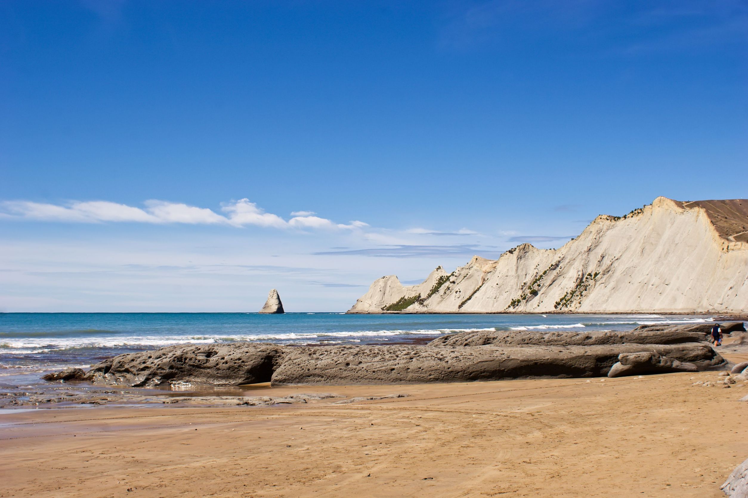
Cape Kidnappers
Cape Kidnappers is a headland located in the south-east extreme of the Hawke’s Bay region on New Zealand’s North Island. A headland is a narrow piece of land that projects from a coastline into the sea; sometimes otherwise known as a cape, bluff, or promontory. Cape Kidnappers extends from Clifton–a small beach town and camping area–into the Pacific Ocean.
Cape Kidnappers takes its English-language name from Captain James Cook’s 1769 voyage to–and around–New Zealand aboard the ship Endeavor. With the caveat that this may be only one side of the story, it was named after an attempted kidnapping. As the story goes, when the Endeavor was anchored off-shore, a crewmember named Tiata was in the water beside the ship when a Māori fishing boat pulled alongside and attempted to drag him aboard. Sailors from the Endeavour opened fire on the fishing boat, killing and injuring several of the Māori. The surviving Māori sped off, and Tiata returned to the Endeavour. Cook, who described the region as having steep white cliffs on either side, thus named the area “Cape Kidnappers.”
 Cape Kidnappers is now a protected area and home to several colonies of the Australasian Gannet. The bird reserves are closed to the public, but may be viewed from the beach which is which is accessible by foot, off-road vehicle, or kayak.
The Māori name for Cape Kidnappers is Mataupo Maui, meaning “the fish hook of Maui.” Another name, used less often, is Tapuwaeroa, which refers to “long footsteps” left behind by the giant Rongokako.
- From the wine department: Hawke’s Bay is one of New Zealand’s largest wine-producing regions in term of production. The region enjoys an overall maritime climate, but its location in the wider portion of the country means that it is, in spots, quite a bit sunnier and warmer than other parts of the country. For this reason, along with its now-famous gravelly, well-drained soils (particularly in the Gimblett Gravels area), Hawke’s Bay has a reputation for red-Bordeaux blends featuring Cabernet Sauvignon and Merlot, as well as Syrah–mainly grown in the areas further inland. The areas closer to the coast produce Chardonnay and Pinot Gris as well as plenty of wine using NZ’s signature grape–Sauvignon Blanc.
Bonus question: Why is part of the ultra-cute town of Westport known as Cape Foulwind? Cape Foulwind is a headland on the New Zealand’s South Island, located close to the art-deco town of Westport (itself located on New Zealand’s west coast overlooking the Tasman Sea). The headland was previously named Rocky Cape, but was christened Cape Foulwind by Captain James Cook after a strong wind off the cape blew the Endeavour quite a distance out to sea.
References:
- The Official Wine New Zealand Website
- The Encyclopedia of New Zealand: Cape Kidnappers
- Te Ara Stories: Cape Kidnappers
- The Encyclopedia of New Zealand: Farewell Spit
- Te Ara Stories: Farewell Spit
The Bubbly Professor is…”Miss Jane” Nickles of Austin, Texas

Pingback: Poverty Bay and the Bay of Plenty | The Bubbly Professor
Pingback: Wine Geo: What (exactly) is a Cape? | The Bubbly Professor