Rah-Rah Rías!
May 11, 2017 Leave a comment
.
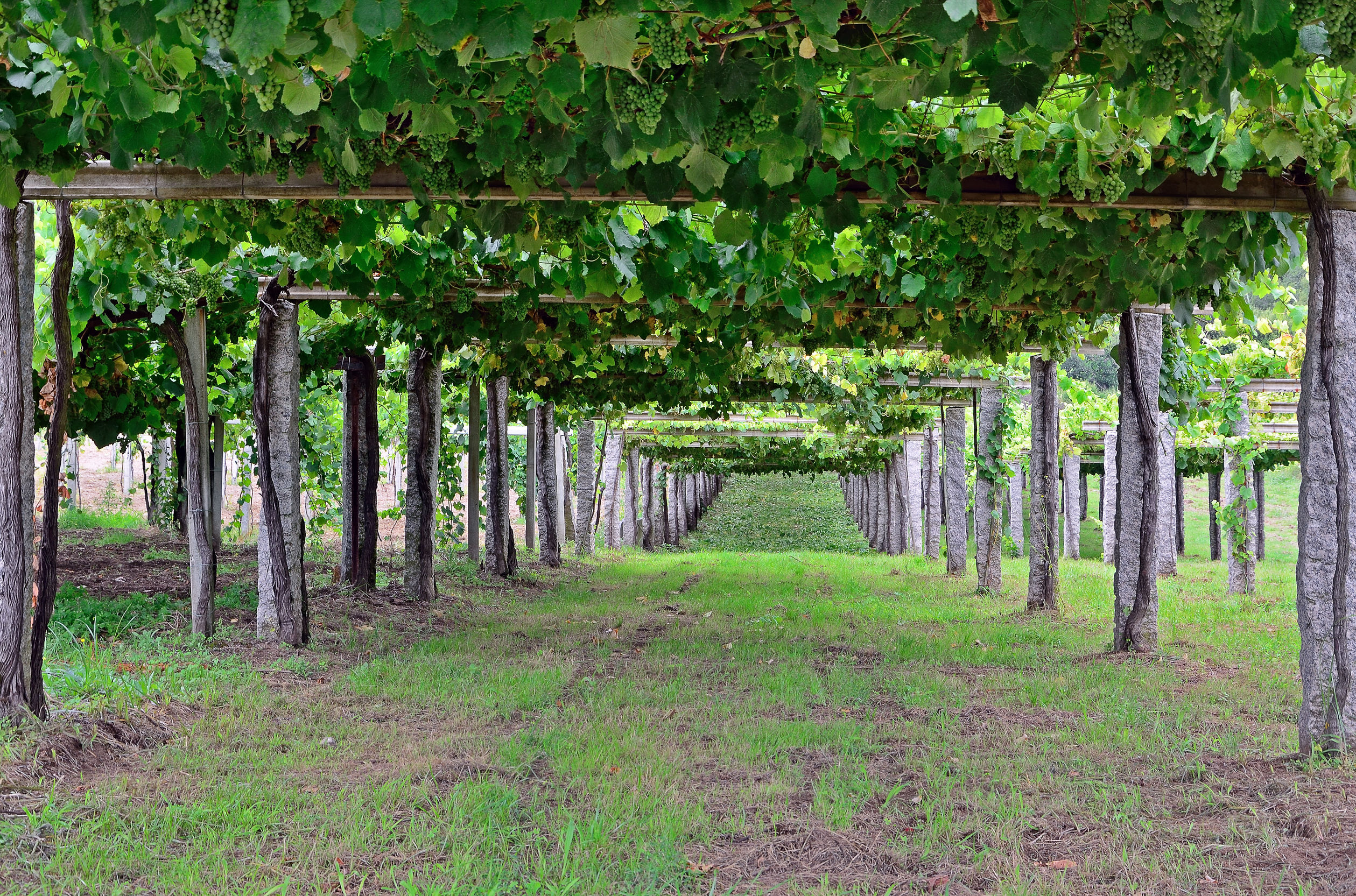
As a wine lover, you must surely have a place in your heart for Rías Baixas, the lovely, Albariño-based white wine from Northern Spain.* Crisp and floral, fruity and refreshing, the wines of Rías Baixas are a white wine lovers dream.
However…do you know what a ría is? The word itself sounds a lot like “río,” so you might just assume that it is a local term for “river.” In which case, you would be just a little bit correct.
A ría is actually a type of estuary. There are several types of estuaries, all of which abide by a definition such as the following:
- Estuary: A partially-enclosed body of water, located on the coast, formed where one or more streams or rivers flow into the ocean. An estuary contains a body of brackish water (a combination of salt water and fresh water) and has an open connection to the sea.
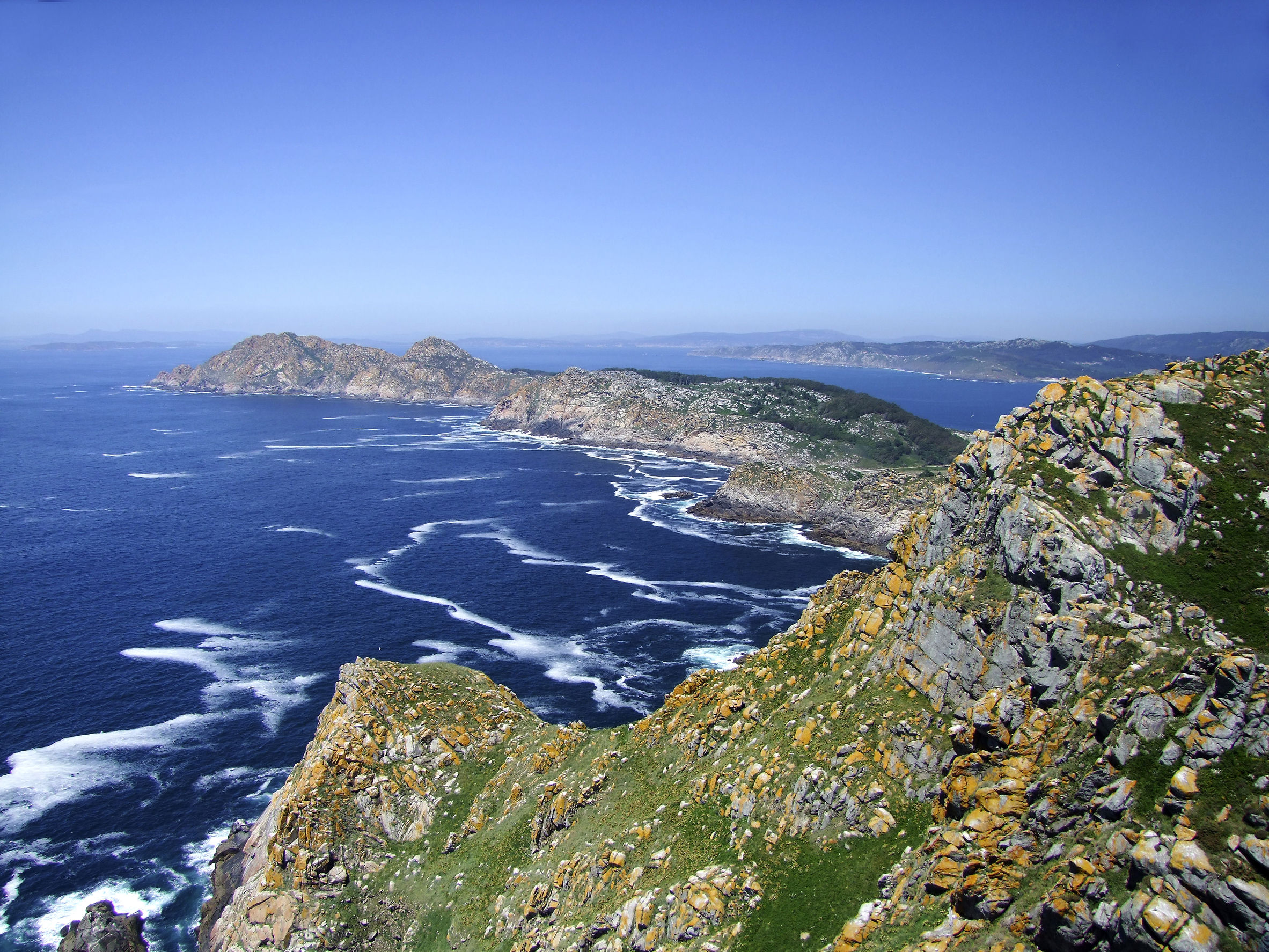
The Cies Islands
A ría is therefore a type of estuary, also known as a drowned river valley or a coastal plain estuary. Rías were formed at the end of last ice age at places where the level of the sea rose in proportion to the coast, and sea water seeped inland into the river valleys. Rías retain the original shape of the river and are usually quite shallow. Rías typically have very rugged, jagged outlines and often include islands as well.
In the United States, Chesapeake Bay, Delaware Bay, and Galveston Bay are all rías. Well-known rías in other parts of the world include Marlborough Sounds (on the northern tip of New Zealand’s South Island), Sydney Harbor in Australia, and the Fiordo di Furore in Campania, Italy (which is technically a ría despite its name).
The coast of Galicia is lined with rías. Those in the north are referred to as the “Rías Altas” (Upper Rías) and are aligned along the “Coast of Death.” Well, the area is not technically referred to as the Coast of Death, but the Galician “Costa da Morte” is a nickname for the region, so-called for the turbulent nature of the waters that in the past led to many shipwrecks.
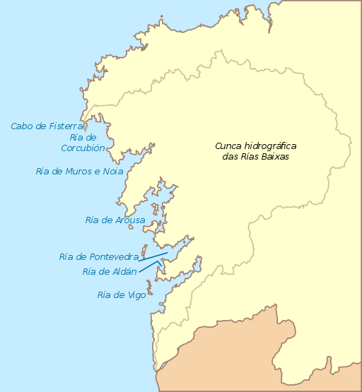
Diagram of the Lower Rías by Hidrogalicia_ES, via Wikimedia Commons
The sea around the Rías Baixas, (the “Lower Rías”) is calmer, due in part to the presence of islands. The DO itself in comprised of five discontinuous areas, located close to four rías. These are, from north to south:
- The Ría de Muros e Noia; formed where the Tambre River meets the sea. This is the smallest of the four rías and the only one not to have an island near the mouth.
- The Ría de Arousa; formed where the Ulla River meets the sea. This is the largest of the five rías. The Ría de Arousa has two lagoons, as well as a large area of sand dunes known as the Dunas de Corrubedo.
- The Ría de Pontevedra, located around the delightful, vacation-worthy town of the same name, is located where the Lerez River meets the sea. This ría contains a small inlet known as the Ría de Aldan. Two small islands, Isla Ons and Isla Onza, are situated at the mouth of the ría. The islands are part of the Parque Nacional Marítimo-Terrestre de las Islas Atlánticas de Galicia.
- The Ría de Vigo, the southernmost, is formed where the Verdugo River meets the sea. The Cíes islands, located at the mouth of the ría, make the area a safe port, and many beautiful marinas are located here.
*Technically, the white wines of the Rías Baixas DO may be produced using Albariño, Loureira, Treixadura, and Caiña Blanca grapes, along with small amounts of Torrontés or Godello—in various proportions depending on label terminology and the sub-region. The DO is also approved for the production of red wines based on Caiño Tinto, Espadeiro, Loureira Tinta, Mencía, Brancellao or Sousón.

The Rande Bridge over the Ría de Vigo
For the geo-curious: other types of estuaries include the following:
- Fjords: Fjords are deep, steep-sided estuaries formed by glaciers. As the glaciers advanced, they would deepen and widen the original river valleys; at the end of the ice age as the glaciers retreated, they left behind the fjords. Fjords can reach depths of up to 1,000 feet (300 m). The coast of Norway is well-known for its numerous fjords; fjords also make up portions of Puget Sound (Washington State), Glacier Bay (Alaska), and Milford Sound (New Zealand).
- Lagoons: Common in tropical areas, lagoons are formed in areas where sediment is deposited at the same rate as the sea level rises to form a body of brackish water separated from the sea by a sand spit or barrier islands. Lagoons are typically quite shallow and parallel to the shoreline, as seen in New Jersey’s Barnegat Bay and Italy’s Venetian Lagoon.
- Freshwater Estuaries: Freshwater estuaries occur where rivers flow into fresh-water lakes. The Great Lakes, located in the United States and Canada, contain many freshwater estuaries.
Other references/for more information:
- http://oceanservice.noaa.gov/facts/estuary.html
- https://www.nationalgeographic.org/encyclopedia/estuary/
- http://omp.gso.uri.edu/ompweb/doee/science/descript/esttype1.htm
- http://omp.gso.uri.edu/ompweb/doee/science/descript/coastpln.htm
- http://doriasbaixas.com/public/manager.php?lang=en
- http://www.verdenorte.com/parque-natural-dunas-de-corrubedo
- http://www.mapama.gob.es/es/red-parques-nacionales/nuestros-parques/islas-atlanticas/
- http://www.turismodevigo.org/en/cies-islands
The Bubbly Professor is “Miss Jane” Nickles of Austin, Texas… missjane@prodigy.ne
