Waitaki World
November 9, 2017 Leave a comment
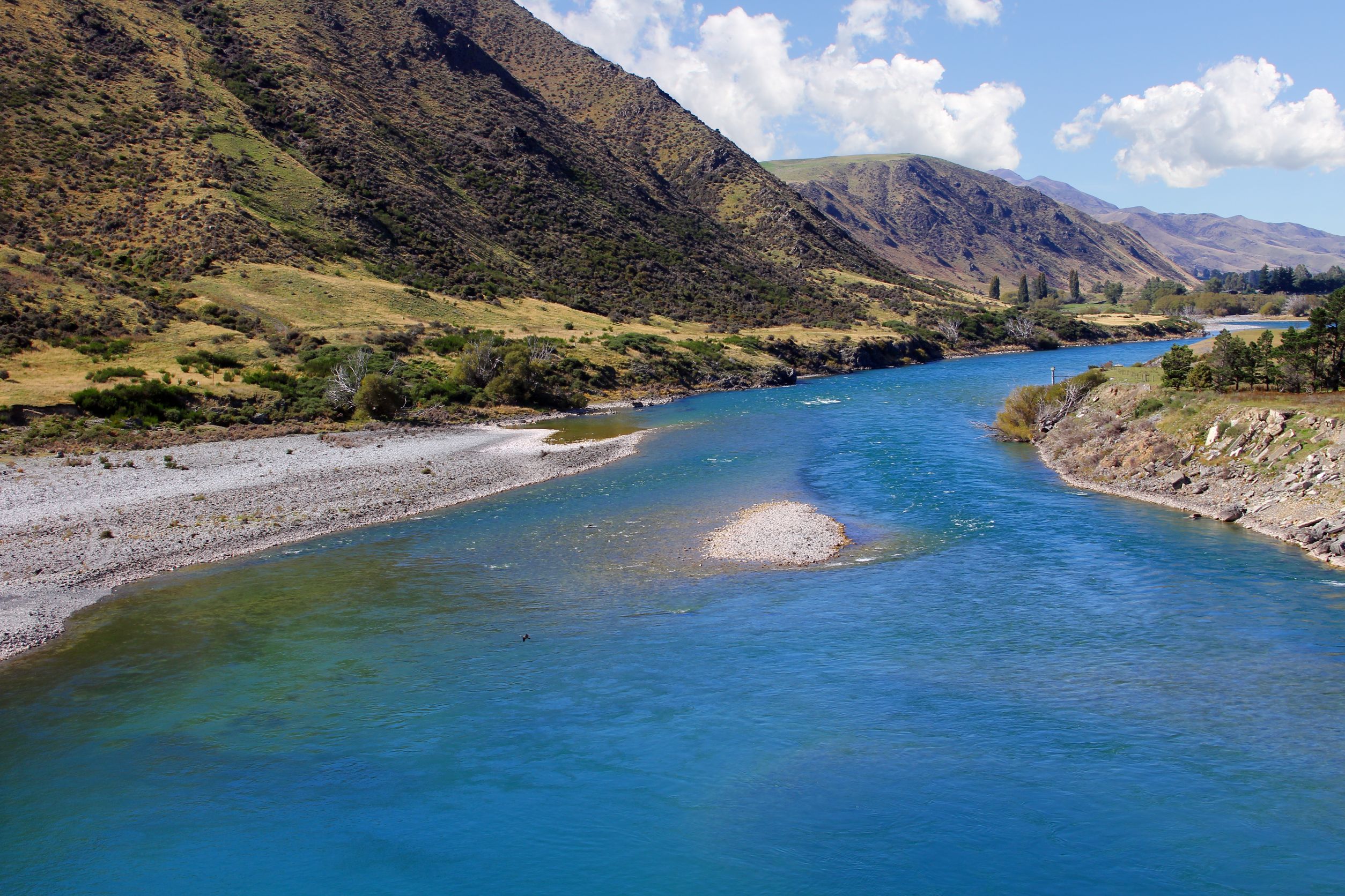
The Waitaki River near Kurow (in the Waitaki District)
Waitaki World—the river, the lake, the district, and two regions for wine
I am a huge fan of everything about New Zealand, in particular New Zealand wines. I’ve been a fan of New Zealand wines since the release of Cloudy Bay Vineyards’ first Marlborough Sauvignon Blanc back in the 1980s. I’ve grown to be an even bigger fan over the years as I’ve been able to experience the rise of Central Otago Pinot Noir, red blends from Hawke’s Bay, serious Méthode Marlborough sparkling wines, and even “carbonated” Sauvignon Brut (delicious).
As such a fan of New Zealand wines, it makes sense that I have been following—with something resembling giddy excitement—the long discussed but newly activated laws regarding the wine and spirit geographical indications of the country. For some background information on the ten-year legal process leading up to this point, click here.)
One thing I discovered during my almost daily check-ins of the website of the Intellectual Property Office of New Zealand/Geographical Indications is that there are two Waitaki Valleys. This was confusing enough, however, upon further research I discovered that there is an entire Waitaki World—including not just the two valleys, but a river, a lake, and a district. Let’s start at the beginning:
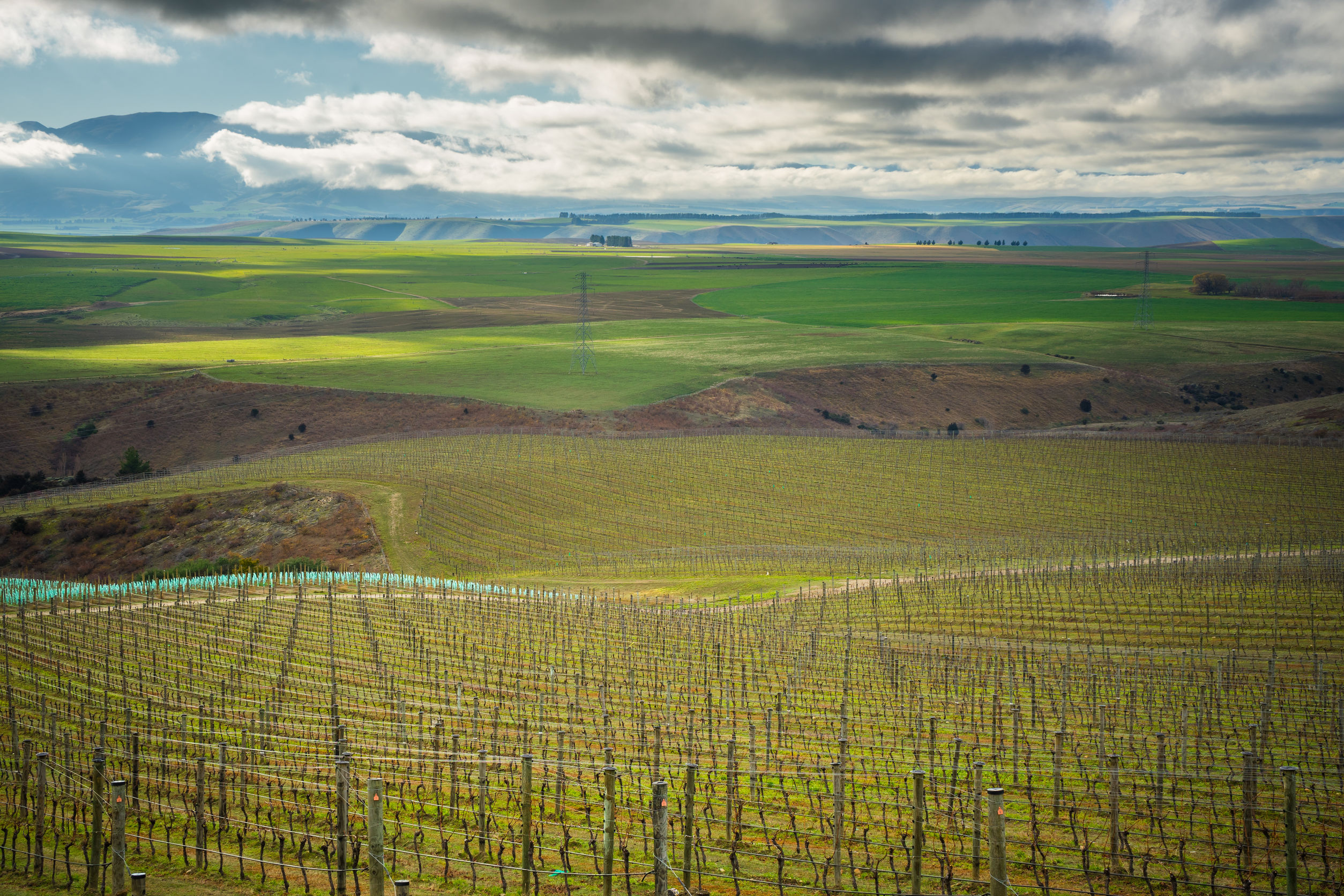
Vineyards in the Waitaki District
The Waitaki River: The Waitaki is a river that begins with several small streams that flow from the Southern Alps (somewhat in the central portion of New Zealand’s South Island) towards Lakes Ohau, Pukaki, and Tekapo. Once past the lakes, the streams weave together to form the Waitaki. The Waitaki River, named for the Maori term for “weeping waters,” then travels eastward for about 130 miles (210 km) until it meets the Pacific Ocean near the town of Glenavy on the island’s east coast. The Waitaki River is a braided river, meaning that it consists of a series of river channels connected and separated by small (and sometimes temporary) islands.
Lake Waitaki: The Waitaki River is also home to one of the largest hydroelectric power projects in New Zealand, and is home of several large dams that create several man-made lakes—such as Lake Benmore, Lake Aviemore and Lake Waitaki—along its path. Lake Waitaki is the smallest and the furthest downstream of the three lakes on the Waitaki River.
The Waitaki District: Here’s where it gets interesting—the Waitaki River served as a traditional—and now political—boundary between the large political regions of Canterbury (to the north) and Otago (to the south). With the hydroelectric plants and other developments along and on either side of the river, it was decided that it would be best to include the entire catchment of the river within one political district. The Waitaki District, with approximately 60% of its area in the Canterbury Region and 40% in the Otago Region, is the only district on New Zealand’s South Island that is split between two political regions.
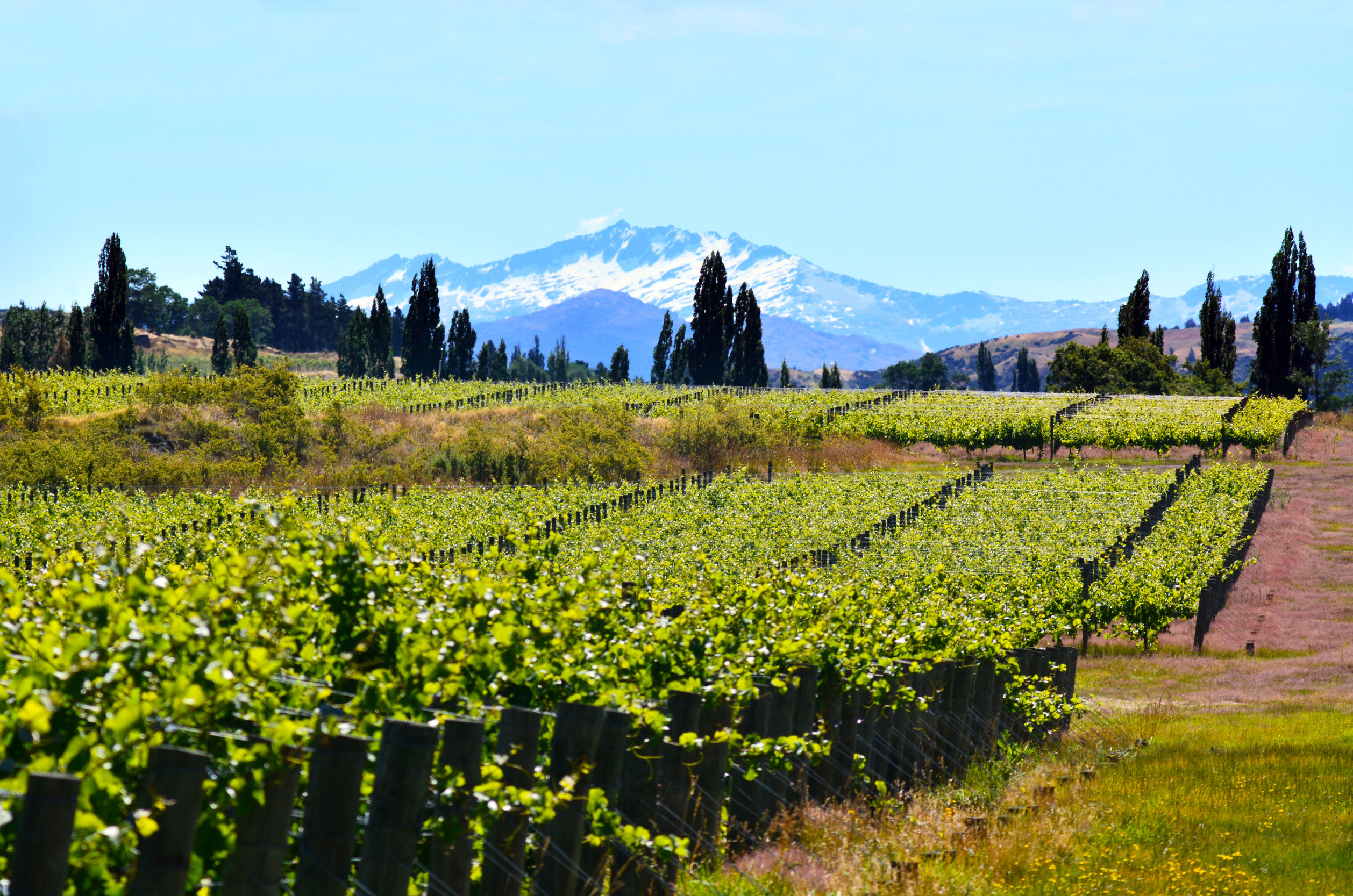
More Waitaki Vineyards…
The two Waitaki Valley wine areaa: Both sides of the Waitaki River include some prime (if remote) viticultural areas, and both political regions—Canterbury and Otago—can lay claim to some of them. So there are indeed two wine regions known as the Waitaki Valley. Here’s where it gets interesting:
- Waitaki Valley/North Otago: The area to the south of the river (located in the Otago Region) is known as Waitaki Valley/North Otago. This area has applied to be an official geographical indication under the new scheme now taking form in New Zealand. (Central Otago, located just to the south of Waitaki Valley/North Otago has also applied to be a GI.)
- The Waitaki Valley of Canterbury: This area is listed on the website of Wines of New Zealand as a sub-region of the Canterbury GI. (Canterbury has applied for official status as a new Geographical Indication.) However, the Waitaki Valley of Canterbury has not applied for GI status—as of today (November 4, 2017)—so for now it joins a long list of New Zealand wine areas that will be considered “unofficial.” As such, the Waitaki Valley area to the north of the river is considered to be an unofficial sub-region of the Canterbury GI.
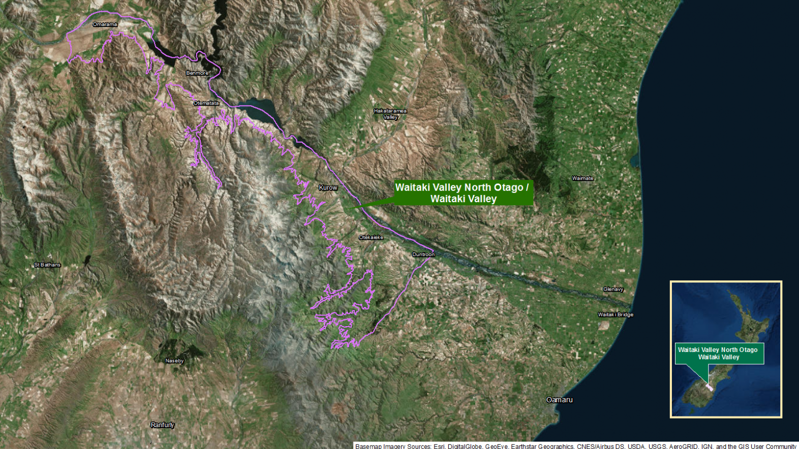
Map of the Waitaki Valley/North Otago Region via: https://www.iponz.govt.nz (click to enlarge)
The Waitaki Valley viticultural areas (on either side of the river) follow the course of the Waitaki River for 46 miles (75 km). The area has unique limestone-based soils—a reminder of its ancient past, when it was covered by the sea—as well as loess and alluvial deposits. The Waitaki Valley(s) are remote, cool-climate areas that are planted mainly to Pinot Noir, Riesling, Pinot Gris, and Chardonnay.
References/for more information:
- http://www.methodemarlborough.org/
- https://www.arawines.com/our_wines/one_estate
- https://en.wikipedia.org/wiki/Waitaki_District
- https://www.iponz.govt.nz/
- https://www.britannica.com/place/Waitaki-River
- https://www.nzwine.com/en/our-regions/waitaki-valley-north-otago/
- https://www.nzwine.com/en/our-regions/canterbury-north-canterbury/
- http://winewitandwisdomswe.com//?s=New+Zealand
The Bubbly Professor is “Miss Jane” Nickles of Austin, Texas… missjane@prodigy.net
