Five Fast Facts about Sonoma Creek
March 13, 2022 Leave a comment
 Sonoma Creek is dwarfed—in length and volume as well as fame—by the nearby Napa River. However, this small-but-mighty creek makes its mark in the southwest corner of Sonoma County in a very big way. Read on to ponder five fast facts about Sonoma Creek!
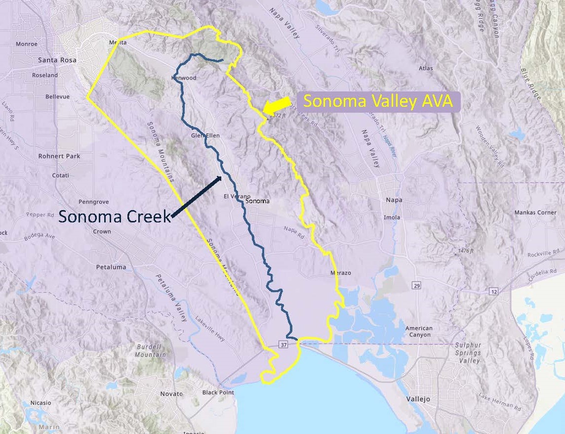
#1: From its source on the west side of the Mayacamas Mountains—Sugarloaf Ridge State Park to be exact—Sonoma Creek measures about 33 miles/54 km in total length. After running (mostly) west for about 3 miles/5 km, the creek takes a turn and flows to the south/southwest through Sonoma Valley before emptying into San Pablo Bay.
#2: There is a waterfall! Sonoma Falls is tucked into Sugarloaf Ridge State Park, near the source of the creek. The park is located a short (3-mile/5-kilometer) drive from Kenwood—just turn east off of Sonoma Highway onto Adobe Canyon Road. From the park’s visitor’s center, you can take any one of several short hikes to Sonoma Creek Falls. The falls are somewhat seasonal, but if you catch it during winter, spring, or after a storm, you are likely to be rewarded with the soothing sound of falling water. At its most lively, Sonoma Falls is multi-tiered and can cascade as much as 20 feet/6 meters.
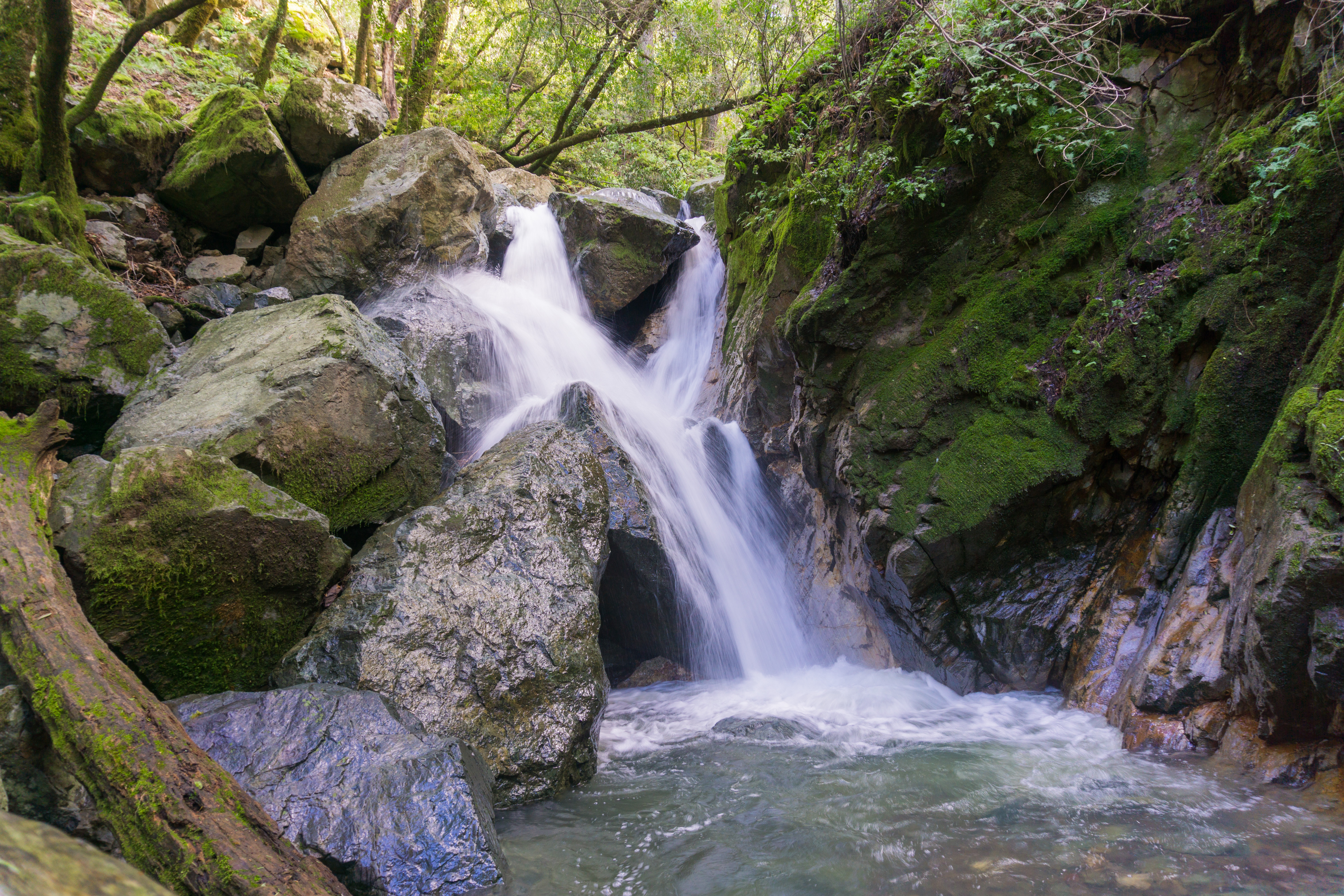
Sonoma Falls (on a good day)
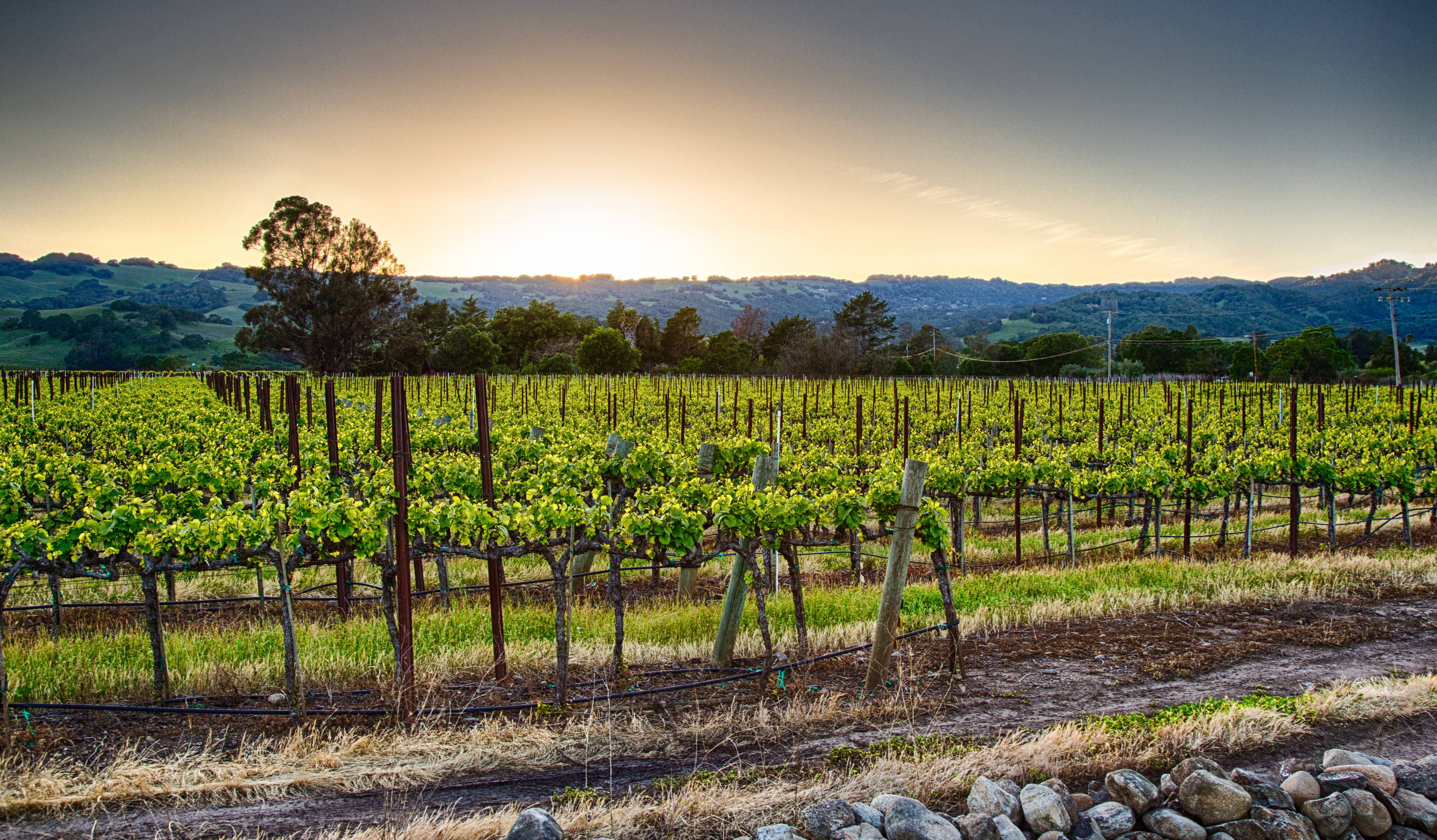
#3: Some of the best-known wine towns in the Sonoma Valley AVA are located directly on Sonoma Creek. The bucolic wine country towns of Kenwood, Glen Ellen, El Verano, and (the town of) Sonoma are located directly on the creek. Dozens of wineries are situated just a few miles from the creek (or even closer)—check out Buena Vista, Kunde Family Winery, Kenwood Vineyards, and Sangiacomo Family Wines.
#4: The Sonoma Creek Watershed is located entirely within the Sonoma Valley AVA. Surrounded by the vineyards of the Sonoma Valley AVA, Sonoma Creek is fed by waters that flow from the very mountains that define the appellation’s boundaries. The Mayacamas—located along the appellation’s eastern boundary—give rise to the headwaters of the creek itself as well as several tributaries including Bear Creek and Calabazas Creek (just north of the town of Glen Ellen). The Sonoma Mountains—forming the northern and western edge of the region—give rise to Yulupa Creek (sourced along the eastern slope of Bennet Mountain), Graham Creek, and Fowler Creek.
 #5: Sonoma Creek is one of the three main bodies of water that course through (and drain) the southern portion of Sonoma County. The southern section of Sonoma County is drained by Sonoma Creek, the Petaluma River, and Tolay Creek. The 18 mile-/29 km-long Petaluma River rises in a series of small hills located between the towns of Cotati and Petaluma. After flowing directly through the town of Petaluma, it forms part of the border between Sonoma and Marin County before emptying into San Pablo Bay. Tolay Creek—located between the watershed of Sonoma Creek and the Petaluma River—rises from Tolay Lake (itself located in a narrow ridge near the southern edge of Sonoma Mountains). Somewhat seasonal, Tolay Creek flows in a southerly direction for 12.5 miles/20 km towards San Pablo Bay. For the last 2 miles/3 km of its run—after it passes underneath Highway 37—Tolay Creek marks the western boundary of the Sonoma Valley AVA.
References/for more information:
- https://www.world-of-waterfalls.com/waterfalls/california-sonoma-creek-falls/
- https://sonomarcd.org/district-watersheds/sonoma-creek/
- https://en.wikipedia.org/wiki/Sonoma_Creek
- https://en.wikipedia.org/wiki/Petaluma_River
- https://parks.sonomacounty.ca.gov/Visit/Tolay-Lake-Regional-Park/
The Bubbly Professor is “Miss Jane” Nickles of Austin, Texas… missjane@prodigy.net
