Five Fast Facts about the Minho River
August 23, 2021 1 Comment
 .
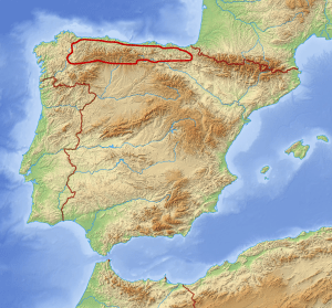
.The Minho River (known in Spain as the Miño, but widely recognized by the Portuguese name Minho) flows south/southwest across Galicia before twisting to the west and defining a portion of the border between Spain and Portugal. At 210 miles/340 km long, the Minho is the longest river in Galicia and the fourth longest on the Iberian Peninsula (following the Douro, Ebro, and Tagus).
The river helps to define several of Galicia’s wine regions as well as Portugal’s Vinho Verde DOC and is, therefore, particularly well-known to students of wine. Read on to discover five fast facts about the Minho!
#1: Pedregal de Irimia—a spot located a few miles (kilometers) east of the tiny town of Meira—is considered to the source of the Minho River. The spot—positioned within the Serra do Meira/Cantabrian Mountains—is very close to the area where the northern edge of the Galician Massif meets the eastern edge of the Cantabrian Mountains. Pedregal de Irimia sits at an elevation of about 2,400 feet/732 km above sea level. The ancient walled city of Lugo—often cited as the river’s source—is located about 45 miles/73 kilometers downriver from Pedregal de Irimia.
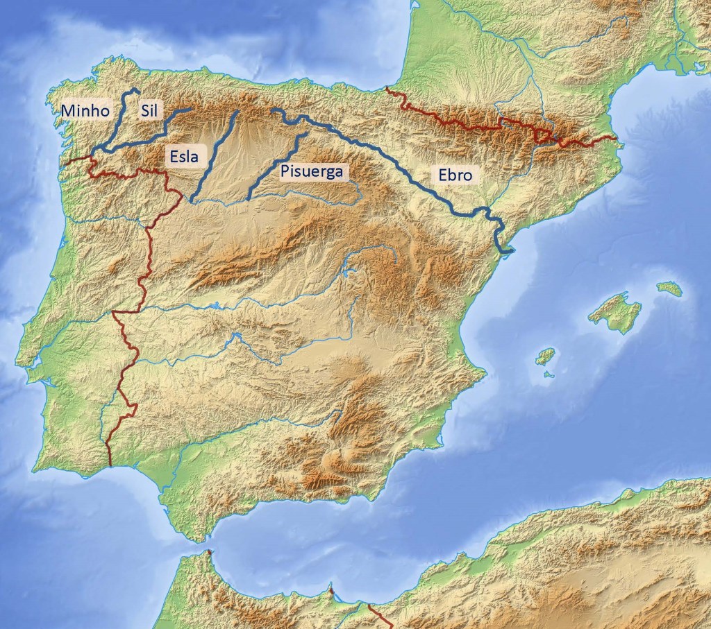
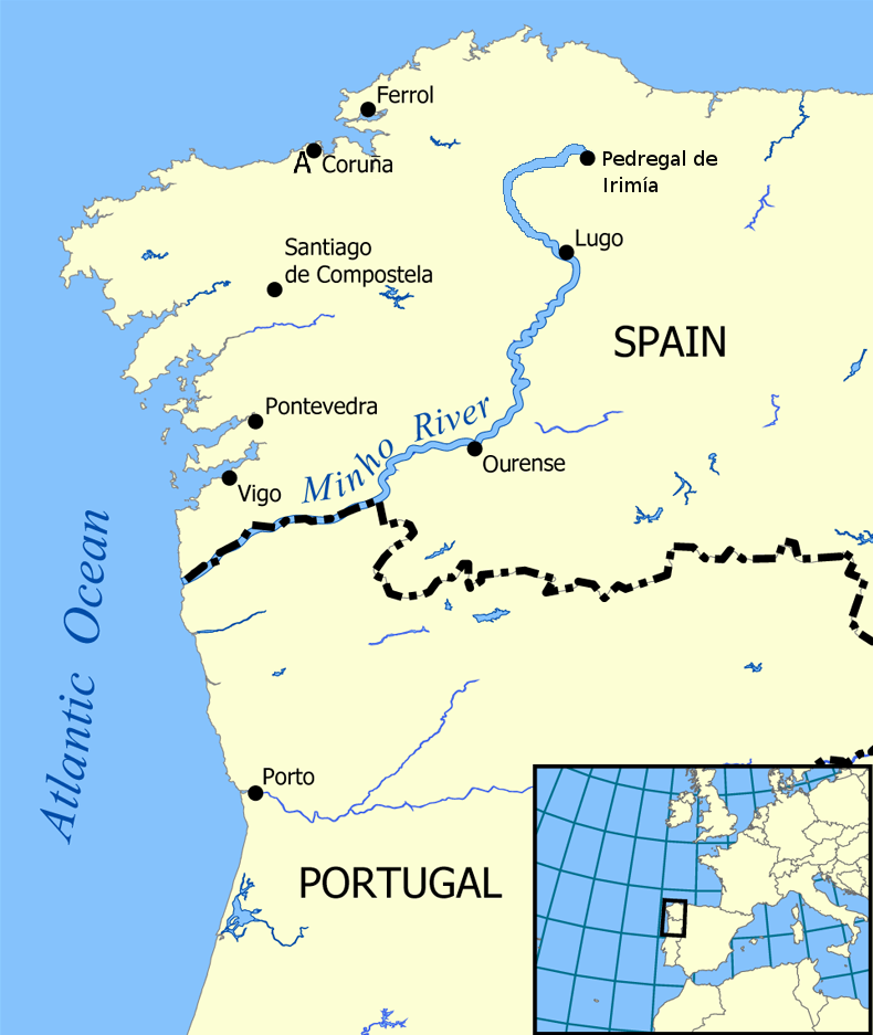 Map of the Minho River attributed to Norman Einstein via Wikimedia Commons
#2: About 17 miles/28 km south of the city of Lugo, the Minho River enters into—and slices through—the Ribeira Sacra DO. Here, the river Sil—once-upon-a-time a rich source of alluvial gold—flows into the Minho. The Sil flows southwest from León (Castilla y León) for about 140 miles/225 km until it joins the Minho in the Galician province of Ourense.
The Ribeira Sacra DO—whose name translates as Sacred Shore, most likely referencing the many churches and monasteries in the region—is known for reds and rosés based on the Mencía grape variety as well as white wines based on Godello. A rather long list of other varieties (including Garnacha Tinta, Albariño, Godello, Treixadura, Loureira, and Torrontés) are also allowed for use in the wines of the Ribeira Sacra DO.
#3: Just a few miles/kilometers after exiting Ribeira Sacra, the Minho flows into the Ribeiro DO. While this DO makes a small amount of Mencía-based red and rosé, white wines are the focus here and make up to 85% of the total production. The leading white grape varieties of the Ribeiro DO—used to create the crisp, fruity, and flavorful wines of the region—include Treixadura, Torrontés, Godello, Loureira, and Albariño.
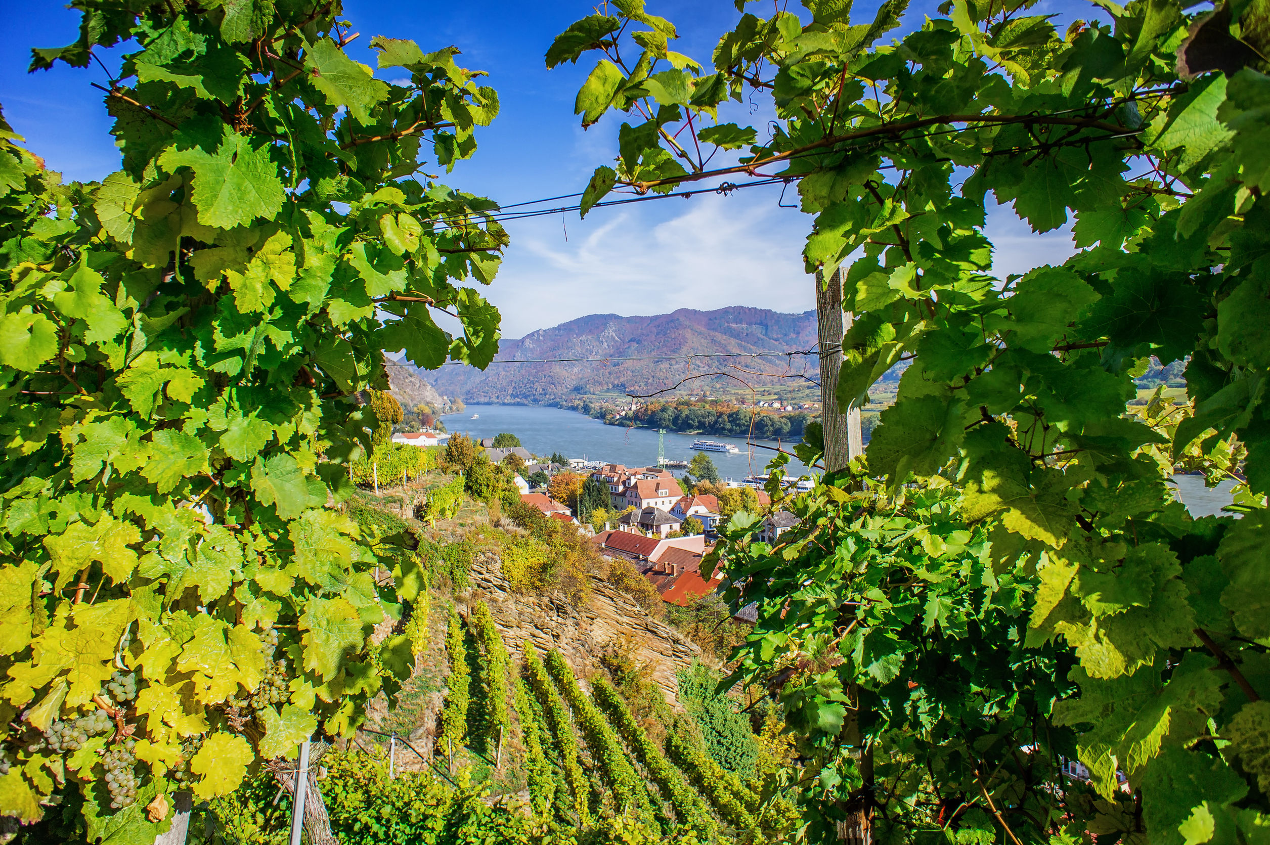
#4: Passing through the eastern edge of the Ribeiro DO, the Minho River flows past the town of Cortegada and carves out the southern boundary of the Condado de Tea and O Rosal sub-regions of the Rías Baixas DO. These regions—characterized by terraced vineyards overlooking the banks of the river—are deservedly famous for their crisp, dry, fruity-and-floral white wines based on Albariño.
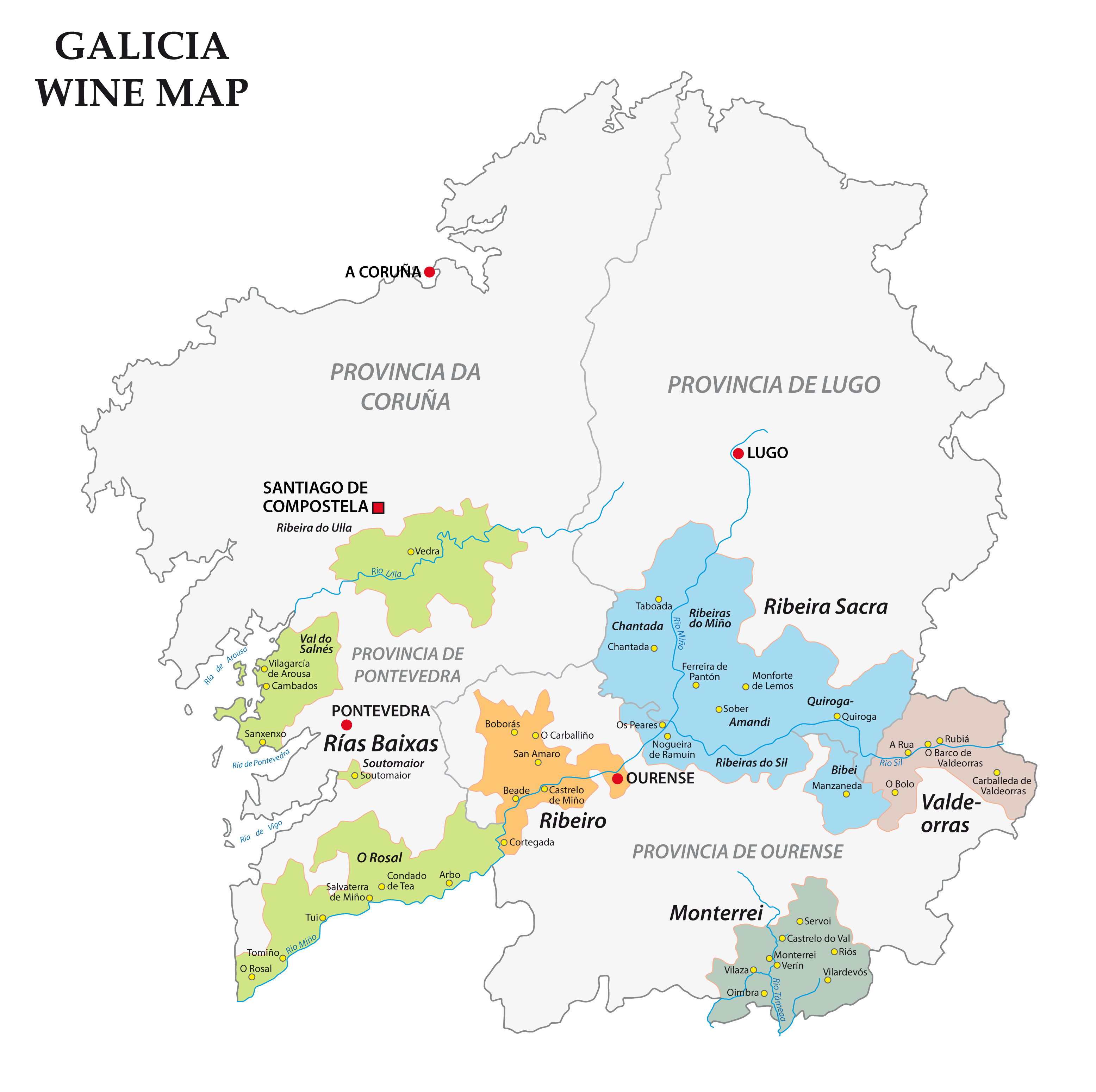 Wine Map of Galicia
#5: On its journey from to the Atlantic Ocean, the Minho River forms part of the border between Spain and Portugal. This part of the river’s journey begins just to the north of the town of Cevide—the northernmost spot in Portugal—and continues westward for about 50 miles/80 km to the sea. Here, the river defines the northern edge of Portugal’s Minho Vino Regional (regional/IGP) wine appellation as well as the Vinho Verde DOC. The Minho/Vinho Verde area is huge, extending as far south as the Douro River and halfway into the interior of the country. This is a lush, fertile area with a good deal of crops, fields, and agriculture of all kinds. Grapevines in the Minho are often trained up high pergolas—or even up and over trees, telephone poles, and fences. This practice makes excellent use of the available land and helps to protect the vines from the possibly harmful effects of the high humidity experienced throughout much of the region.
Vinho Verde is famous all over the world as an inexpensive, easy-drinking, widely accessible wine. While the name translates to green wine, the reference is to the wine’s flavor profile—the wine is meant to be consumed young, white it retains its crisp, fruity, and thirst-quenching style—and not its color (which can actually be red, white, or pink).
The Minho River reaches its final destination—the Atlantic Ocean—between the Spanish town of A Guarda and Portugal’s Caminha. This is the river’s widest point—it measures as much as mile/2 km across and at this stage is considered an estuary, complete with low-tide sand bars visible from either shore.
References/for more information:
- Robinson, Jancis, and Julia Harding: The Oxford Companion to Wine, 4th Edition. Oxford, 2015: The Oxford University Press.
- https://www.waymarking.com/waymarks/wm139BX_Minho_river_Meira_Lugo_Galicia_Espaa
- https://en.wikipedia.org/wiki/Minho_(river)
- The Regulatory Council of Ribeira Sacra-Galicia-España.
- DORiasBaixas
- https://www.wine-searcher.com/regions-ribeiro
The Bubbly Professor is “Miss Jane” Nickles of Austin, Texas… missjane@prodigy.net