The Icy Benguela

...

I’ve been curious about the Benguela Current for a while. My original curiosity about the Benguela Current was about the name —how did it get that very cool name? It seems it all begins with Portuguese sailors in the 1500s.

In the Age of Discovery, Portuguese Sailors—known for skill and courage in ocean navigation —often sailed the long and arduous ocean journey around the continent of Africa to Asia. During such voyages, they had to fight against two mighty ocean currents: the icy Benguela current that flowed northward along the coast of Africa while they were trying to sail south; then, after they rounded the Cape of Good Hope, they sailed north while fighting the warm and southward-flowing Agulhas Current. If the journey was successful, they reached Asia and accessed the famed Indian Spice Routes. Such accomplishments helped the Portuguese form their empire, which at various times included parts of Africa, the Middle East, India, South America, and South Asia.

...

The namesake of the Benguela Current (as it is now known) is a city in present-day Angola.  The area surrounding Benguela, due to its location near the coast and a well-traversed deep bay, has been a center of commercial trade since ancient times.  While there is no written record of the history of the area before the arrival of the Portuguese in 1546, it is believed that the area was formerly known as ombaka, which means, literally, “commercial (or ‘market’) port.” When the Portuguese colonized the area, a town was founded and named São Felipe de Benguela (Saint Philip of Benguela) after King Philip II of Spain and Portugal.

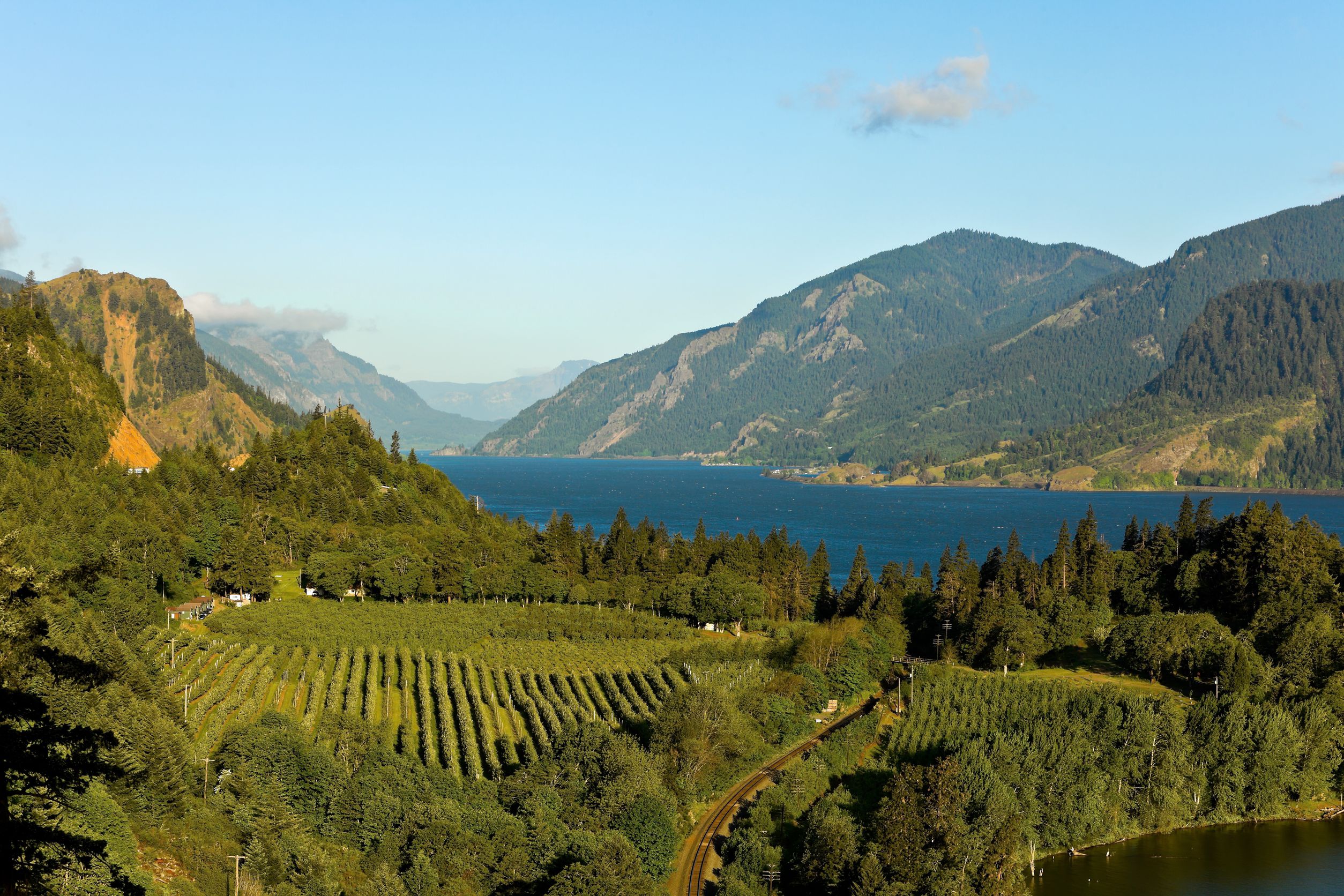
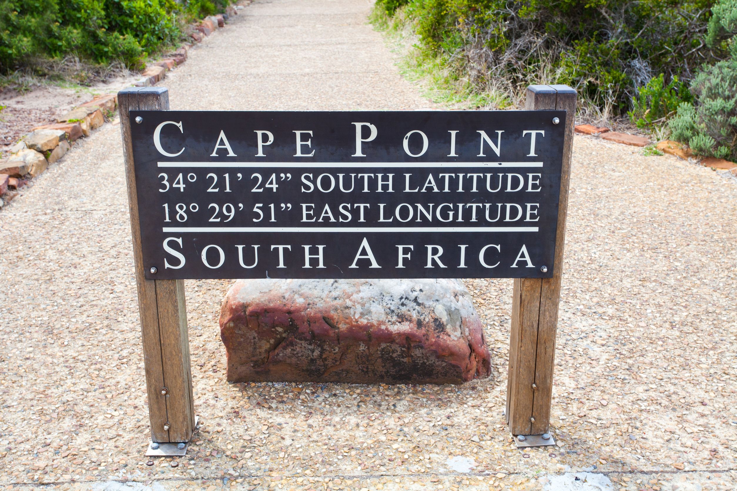
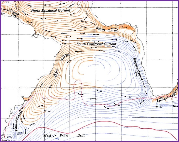
So back to ocean current: the icy Benguela Current flows from the Southern Ocean near Antarctica and moves north along the west coast of Africa. It reaches as far north as Angola (close to the city of Benguela, in case you missed that point) before it turns west and heads to South America. The Benguela Current is part of a large circulating ocean current known as the South Atlantic Ocean gyre. The western edge of the gyre is known as the Brazil Current; the Brazil current flows southward down the coast of Brazil, then turns east and flows across the ocean until it reaches Antarctica. From Cape Point in South Africa (at about 33°), the cold portion of the current known as the Benguela current flows northward along the west coast of Africa to the area around Angola/Benguela (about 16°S).

...

            Cape Agulhas…pick your ocean!

Near Cape Point, where a portion of the cold Benguela Current of the Atlantic meets the warm south- and west-flowing Agulhas Current of the Southern Pacific Ocean, the waters become wild and turbulent. It’s a common practice while on vacation in Cape Town to journey down to Cape Point, take a short hike, get your picture taken by the sign, and stare out to sea at the “place where two oceans meet.” (Hey, I did it.) However, the truth is that the ocean currents actually intermingle for hundreds of miles in either direction—both east and west of Cape Point—and that the “point where two oceans meet” is likely to be anywhere between Cape Point and about 100 miles west at Cape Agulhas (which is actually the southernmost point on the African continent and worth a visit as well).

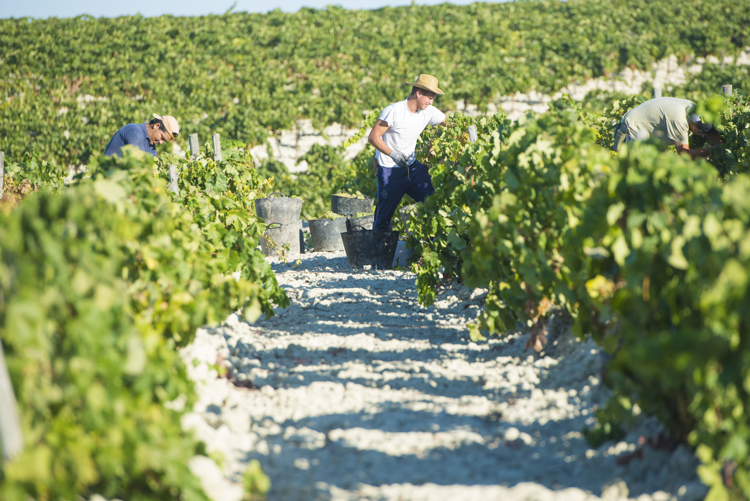
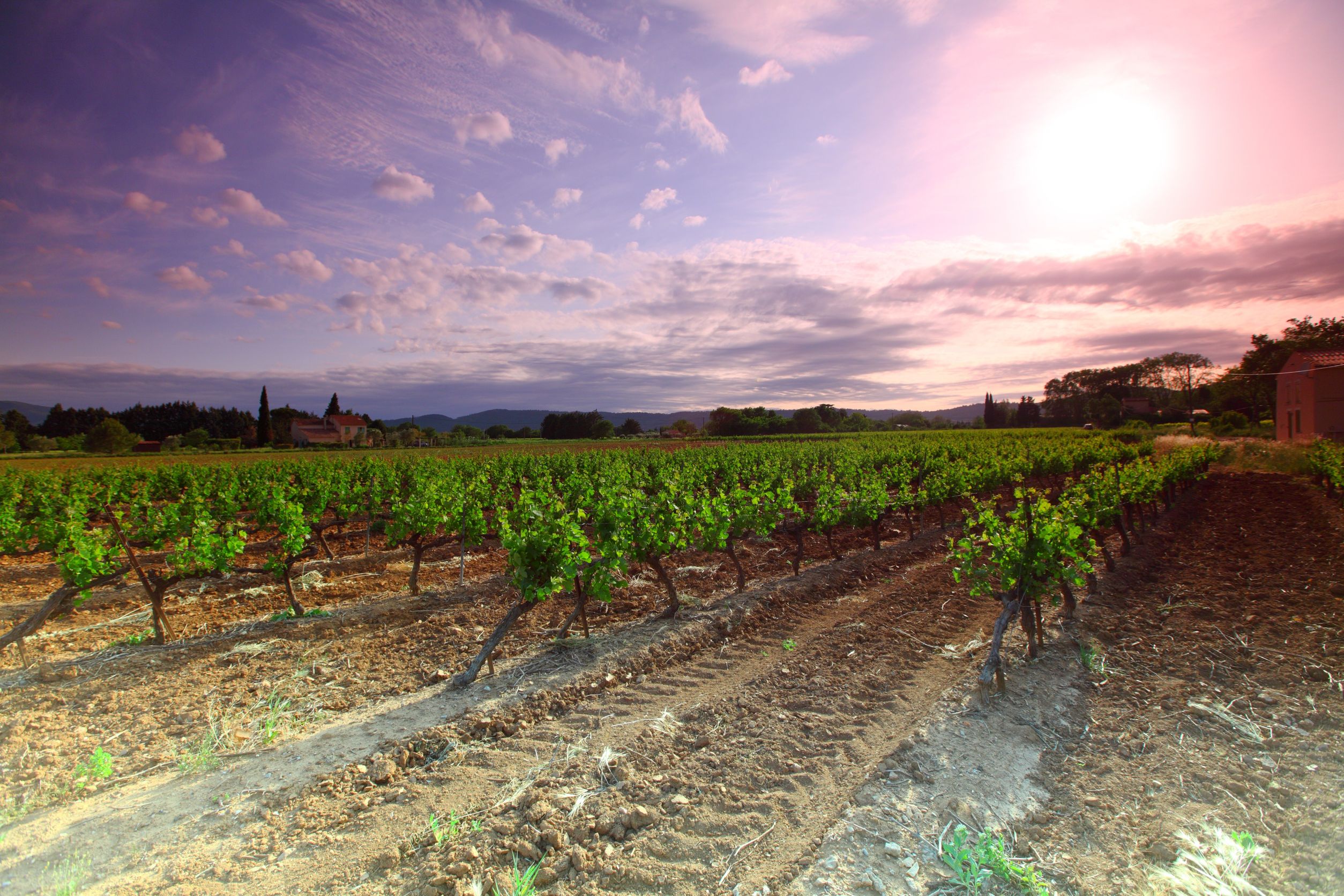
From the department of I thought this was a wine blog:  Good point. All I can say is that my curiosity concerning Benguela Current peaked while studying the wines of South Africa. The winelands of South Africa’s Western Cape are cooled by the moist fog and gentle breezes generated by the Benguela Current, which also generates the not-so-gentle south-easterly wind known as the “Cape Doctor.”

...

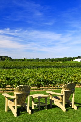
Super-sharp students of wine might also have perked up with the mention of Cape Point, which is the former name of the Cape Peninsula wine district; and Cape Agulhas, a wine district located in the Cape South Coast. Cape Peninsula is a small area located on a narrow, rugged area just south of Cape Town and east of Constantia (both wine regions are easily accessed via taxi or tour bus from Cape Town). Cape Peninsula produces snappy, cool-climate white wines and is particularly adept at Sauvignon Blanc. The terroir of Cape Agulhas, about 100 miles down the coast, is also markedly maritime—distinctly cool and breezy—and known for a crisp, snappy style of Sauvignon Blanc, apricot-and-lemon laced Semillon, and a unique cool-climate style of Shiraz.

References:

The Bubbly Professor is “Miss Jane” Nickles of Austin, Texas… missjane@prodigy.net


Roll on, Columbia, Roll on!

Map of the Columbia River watershed, with the Columbia River Highlighted. Map via the USGS, modified by Kmusser, via Wikimedia Commons

Map of the Columbia River watershed, with the Columbia River Highlighted. Map via the USGS, modified by Kmusser, via Wikimedia Commons

The Columbia River is well-known to wine lovers as the namesake of The Columbia Valley AVA. The Columbia Valley AVA is the largest AVA in Washington State, and a portion of the AVA dips down across the Oregon border as well. Another namesake, the Columbia  Gorge AVA – a tiny AVA located just to the east of Mount Hood – is also shared by the two neighboring states.

But the Columbia River extends well above and beyond its namesake wine regions, and is a treasure trove of interesting stories for geography geeks and travel buffs as well as the legions of wine lovers already familiar with the name.

The Columbia River flows for over 1,243 miles, beginning in the Rocky Mountains of British Columbia in Canada. From there it flows northwest through a glacial valley between the Canadian Rockies and the Columbia Mountains to a town named Canoe; here the Columbia takes a sharp turn to the south around the northern edge of the Selkirk Mountains and begins its 200-mile trek into eastern Washington State.

Once in Washington, the Columbia River flows south/southwest for about 100 miles to the town of Deer Meadows.  Just after the point of confluence with the Spokane River, the Columbia River takes a sharp turn to the west and forms a huge “C” formation covering much of interior Washington State. This section of the river, known as the “Big Bend” was formed during the Missoula floods. Before the floods, the river took a much straighter path towards the southwest.

Crown Point, Columbia Gorge

Crown Point, Columbia Gorge

To the south of the “Big Bend,” in the wine country of eastern Washington State, the Columbia is joined by the Yakima River as the Yakima flows eastward down from the Cascades. The Yakima River catches the Columbia just after it rounds a small bend hugging the Horse Heaven Hills AVA. From here, the Columbia continues its trek to the Pacific Ocean, forming over 300 miles of the border between the states of Washington and Oregon from the Yakima Delta to the sea.

Near Washington’s Tri-Cities area, the Columbia River is joined by the Walla Walla River. Walla Walla is another name familiar to wine lovers, being the namesake of the Walla Walla River Valley AVA, a sub-region of the Columbia Valley AVA and one of the three AVAs shared between Washington State and Oregon.

The Walla Walla River is short in length – just 61 miles long – but of great importance to the wines of the area. The Walla Walla River begins in as two separate forks in the Blue Mountain range of northeastern Oregon. From there, the two forks run westward to Milton-Freewater, which was built along its banks. The Walla Walla River runs northwest and eventually meets the Columbia River for the journey westward towards the sea, but along the way it deposits the famous basalt stones – the rocks – which gave the newly-anointed “Rocks District of Milton-Freewater AVA” both its name and its famous terroir.

Shoshone Falls

Shoshone Falls

Another river familiar to wine lovers, the Snake River, joins the Columbia River near Washington State’s Tri-Cities area. The Snake River, at 1,078 miles long, is the Columbia River’s longest tributary. The Snake River actually begins several states over, in Wyoming’s Yellowstone Park. From Wyoming, the Snake flows across the width of Idaho. About mid-way through its trek across Idaho, the Snake River flows over Shoshone Falls – a waterfall that, at 212 feet high, is actually 45 feet higher than Niagara Falls. Shoshone Falls is often called “the Niagara Falls of the west” – although I am sure many citizens of Idaho wonder why Niagara Falls is not known as “The Shoshone Falls of the east.”

About 120 miles west of Shoshone Falls, the Snake River flows past Boise, and not too far after that,  takes a sharp turn north and forms the border between Idaho and Oregon. The Snake River Valley AVA is located along this border. The Snake River Valley is currently Idaho’s only AVA, although a second – Lewis-Clark Valley – has been proposed for northern Idaho/eastern Washington State. After leaving Oregon and forming a small portion of the Idaho/Washington State border, the Snake River turns west and joins the Columbia River.

Map of the Snake River watershed with the Snake River Highlighted. Map via the USGS, modified by Shannon1 via Wikimedia Commons.

Map of the Snake River watershed with the Snake River Highlighted. Map via the USGS, modified by Shannon1 via Wikimedia Commons.

The Columbia River, along with its tributaries the Walla Walla River, the Snake River, and the Yakima River (as well as many others not mentioned here) plays a huge roll in Pacific Northwest viticulture. Through their waters, they provide for the irrigation that makes viticulture even a possibility in much of the region. Over the centuries they have deposited alluvial soils, formed breathtaking waterfalls, sliced gorges through mountains and even delivered the namesake “rocks” to one of the area’s newest AVAs. Roll on, Columbia, Roll on.*

*Roll On, Columbia, Roll On is an American folk song written by Woody Guthrie in 1941. The popular song glamorized the building of a series of dams and the harnessing of hydroelectric power from the Columbia River under the American Public Works program of the New Deal.

The Bubbly Professor is “Miss Jane” Nickles of Austin, Texas… missjane@prodigy.net

The Land of the Landes

Maritime Pines in the Landes Forest

Maritime Pines in the Landes Forest

All good wine students know about the Landes Forest—that region of tall pines bordering the Bay of Biscay to the south and west of the Bordeaux wine region. The Landes—now the most extensive forest in France at 5,400 square miles (14,000 square km)—helps to somewhat moderate the Atlantic Ocean’s cold, maritime influence on the vineyards of Bordeaux.

However, even the sharpest wine student might not know the history of the region, including how local sheep-herders used to wear stilts to navigate the land, and the fact that the forest is largely man-made.

The area we now know as the Landes forest was once covered by moors and marshlands.  The area, basically a swamp surrounded by shifting sand dunes, was sometimes known as the “Moor of Bordeaux.” Not surprisingly, the area was sparsely populated. Another nickname given to the region was “the Sahara of France” due to the fact that it was notoriously difficult to travel across—as many pilgrims making their way from the north down to the Camino of Saint James needed to do.

Beginning in 1801, the marshes were drained via a vast system of canals, the land was cleared, and pine tree plantations were established. This stabilized the sand dunes and created arable land suitable for farming. The local economy benefited through farming (mainly corn) as well as new opportunities in the timber, pine resin, and paper industries.

Jean Louis Gintrac - Inhabitants of the Landes (circa 1808)

Jean Louis Gintrac –
Inhabitants of the Landes (circa 1808)

The benefits of the man-made Landes Forest went beyond the area’s new industrial prowess, as it was soon discovered that the near-by wine region of Bordeaux also benefited. This is due to the area of the Landes forest closest to the Médoc that shelters the vineyard regions from the bracing cold and howling breezes that blow in from the Atlantic. Thus, the vineyards of the Médoc are now able to fully ripen the Cabernet Sauvignon and Merlot that form the basis of the region’s red wines.

The Landes forest is one of the largest man-made forests in all of Europe, as well as a unique example of a man-made landscape that continues to benefit its region and the surrounding areas. The timber, pine resin, and other related industries are still active in the area, although a good portion of the region is now given over to tourism.

The area is also home to a large protected area of forests and coastlines that includes the Landes de Gascogne Regional Natural Park (Parc Naturel Régional des Landes de Gascogne). The park provides ample opportunities for hiking, cycling, and picnicking, and contains a bird sanctuary and a museum. The museum, L’Écomusée de la Grande Lande, focuses on the history as well as the architectural and cultural heritage of the region including, of course, the vineyards and wines of Bordeaux.

The Bubbly Professor is “Miss Jane” Nickles of Austin, Texas… missjane@prodigy.net

References:

Map of the Landes de Gascogne by Cabaussel, via Wikimedia Commons

Map of the Landes de Gascogne by Cabaussel, via Wikimedia Commons

White–ish: Albariza Soil

....

….

Albariza, the word: According to Miriam-Webster.com, the word “albariza” is “borrowed from Spanish, a noun derivative from the feminine form of albarizo meaning “white-ish, or off-white.” Derived from the word albar (“white”) plus the attenuating (limiting) suffix –izo.

Albariza, the soil: According the Oxford Companion to Wine, albariza is “A local, Andalusian term for the white, chalky-looking soil typical of parts of the Jerez region of southern Spain. It appears dazzling white in summer, and has the characteristic of drying without caking, slowly releasing moisture to the vines during the growing season.”

Albariza, for wine lovers: If you are a wine lover, you probably already know a few things about albariza soil. Such as, it is a particularly fine conduit for the Palomino grape, and grows the grapes that will become some of the finest examples of Fino Sherry—and other types of Sherry as well.   It is the main soil type found in the Jerez-Xérès-Sherry DO, found in over 90% of the vineyards of the region.  This figure used to be much lower, but over the years inferior vineyards were replaced—either by other crops such as sunflowers or alternative uses such as the harvesting of solar energy—leaving behind the high quality, albariza-rich vineyards to rule the area.

.....

…..

Albariza is a unique soil, made up primarily of limestone rich in calcium carbonate that, according to geologists, is “almost chalk,” but it is still too young to be true chalk. Yet, to us mere mortals, calling it “chalk” is “close enough,” and you’ll find most people—even viticulturists—referring to albariza as a “chalky” soil. Clay and sand (silica) are found in smaller amounts; these components give its somewhat mottled “white-ish” appearance as opposed to pure, bright white.

The unique properties of the soil allow it to soak up rainfall—which typically occurs in Jerez in the winter—and absorb it like a sponge. Later, the upper levels of the soil “bake” into something of a hard crust or cap, trapping the water below. Over the long, hot, and dry Jerez summer, the trapped water is slowly released, nourishing the vines and making irrigation unnecessary.  The unique white-ish color of the soil also benefits the vines by reflecting sunlight back up to the vines, increasing the rate of photosynthesis.

All of the above might not be new information if you are already a wine enthusiast or dedicated student of wine—which is just fine because there is so much more to know about albariza. Read on for a few more fascinating facts about albariza:

  • The finished product...

    The finished product…

    Albariza soils are categorized according to the percentage of calcium carbonate-rich limestone/chalk in the soil. Alabarizone soil is mostly clay but contains about 10% limestone. Tosca soils have about 40% limestone/chalk, while lantejuela contains about 50%. Tajón has the most – up to 80% limestone/chalk, giving it the brightest white appearance. However, tajón soils are not ideal for vineyards, as the soil can become very hard, which can lead to chlorosis (a condition where leaves produce insufficient chlorophyll).

  • The ideal version of the soil for vineyards contains about 25% limestone/chalk at the surface, and 40-60% starting a few feet below the surface. Geologists, of course, have many more subsets and ways of looking at albariza, including the composition of the remainder of the soil components as well as specific minerals and nutrients.
  • The finest albariza soils are characteristically loose and easy to work; in geology speak this is described as being “friable.” This friability allows a vine’s root system to spread far and deep into the ground. Roots as long as 38 feet (12 meters) have been reported in layers of albariza soil which themselves reach a depth of 20 feet (6 meters).
  • To maximize the amount of rain water “captured” in the soil, the soil in albariza soils are often “banked up” to create reservoirs to capture rain. In spring, the soils are leveled out again.
  • Albariza soil can hold up to 34% of its weight in water.
  • Albariza is also found in parts of Penedès, where it produces grapes for exceptional Cava; and in Montilla-Moriles, where the vineyards are mostly planted to the Pedro Ximénez variety.

 References:

The Bubbly Professor is “Miss Jane” Nickles of Austin, Texas… missjane@prodigy.net

It’s all about that CLORPT

.

.

It happened again. All I really wanted to do was to get a quick, google-assisted definition of the word “colluvial.” I had read somewhere (the particular book, magazine, or webpage long since totally forgotten) that many of the soils in Alsace were colluvial.

Colluvial soils, it turns out,  are made up of materials that tend to accumulate at the bottom of steep slopes and cliffs, mainly via the action of gravity – as opposed to alluvial soils, which accumulate due to the action of rivers and streams.

But here’s what I also found out…we are living in the pedosphere! The pedosphere, which rests above the lithosphere (basically the earth’s crust and mantle) but below the atmosphere, is the outermost layer of the earth. It is where soil lives, and where soil is formed, via the weathering (breaking down) of minerals, the decomposition of organic matter, and everything moving around (as in living things moving around, as well as -ahem – colluvial and alluvial actions). The pedosphere is the foundation of all plant life (and therefore animal life) on the planet. And here we thought it was all about the specific flavor of Riesling from the Haut-Rhin!

Soil has Texture

Here’s something else I learned: soil has texture. Good students of wine most likely know that the particles that make up soil are categorized by size, with clay being the smallest, silt the intermediate, and sand the largest. The blend, so to speak, of the particles is what makes up a soil’s “texture.” There are actually 12 major soil classifications, as defined by the USDA. Some of these, such as “sandy clay” or “silty clay” are self-explanatory; while “loam” is made up of somewhat equal parts of sand, silt, and clay.

.

.

Soil has Color

We know about bright-red terra rosa and glistening gray llicorella, so it shouldn’t come as a big surprise that the color of soil varies according to mineral content, organic material, and water. That lovely orange/brown color signals high iron content. Dark brown or black soils are high in organic material. A well-drained soil is brightly colored, while a poorly drained soil will show an uneven pattern of red, yellow, and gray.

Soil has Structure.

Is this beginning to sound a bit like wine? Color, texture, structure? Perhaps that’s a stretch – but you have to admit all things are connected. The structure of soil relates to how the soil particles arrange themselves into small clumps, called “peds.” Peds vary due to the nature of the particles themselves and the conditions under which they were formed. For instance, getting wet and drying out, freezing and thawing, being walked on, having things grown in it, and/or being moved around can all influence the nature of the peds.

There are six basic ways to describe soil’s structure, based on how these peds interplay. They are: platy, prismatic, columnar, blocky, granular, and single-grained. Platy soil is thin and flat; sometimes the result of being walked on or otherwise compacted. Prismatic soil is formed into columns; columnar soil is also formed into columns but with a salty “cap.” Blocky soil is irregular. Granular is crumbly, usually the result of plant growth. Single-grained soil refuses to “clump” together.

.

.

Good/Bad Dirt = Texture, Structure, and CLORPT

Soil “behaves” based on a combination of texture and structure. What a farmer might call “good soil” may be a granular soil with a loamy texture, as it holds water and nutrients. A vigneron, however, might prefer a sandy clay soil with a blocky texture, as it would be well-drained of both water and nutrients.

As for the specific soils we wine students love to talk about – jory, tufa, greywacke, marl, schist, shale, slate…they differ due to five major factors, known as CLORPT. (Now there’s a term I bet you never heard before!) CLORPT stands for climate, organisms, relief, parent material, and time – all the things that go into the various vineyard soils, all over the world, that make such tasty wine. And, lest we forget – they support all plant life and therefore animal life as well – one must eat before one can drink.

The Bubbly Professor is “Miss Jane” Nickles of Austin, Texas – missjane@prodigy.net

Note: I researched this post using about two dozen Wikipedia pages, the Soil Sciences of America Association,  and the “gardening resources” page on the Cornell University website.

The Southern Alps, Mount Cook, and the Nor’westers

Mount Hood Hiking Path

Mount Hood Hiking Path

Students of New Zealand wine are familiar with the mountain range known as The Southern Alps. They can probably tell you that the mountain range extends along much of the length of New Zealand’s South Island, forming a rain shadow that keeps a good portion of the eastern side of the island warm and dry. For this reason, the wine regions of Marlborough, Canterbury, and Central Otago are able to grow some of the finest Sauvignon Blanc, Chardonnay, and Pinot Noir in the world.

The Southern Alps run for about 275 miles, forming a natural dividing range along the entire length of the South Island. New Zealanders often refer to the range as the Main Divide, as it separates the more heavily populated eastern side of the island from the somewhat wilder west coast. A large portion of the mountain range, which includes glaciers, glacial valleys, and lakes, is inaccessible except to the heartiest of mountaineers, and enjoys the protection of the National Park Service.

The highest peak in New Zealand, Mount Cook (also known by the Maori name “Aoraki,” said to mean “Cloud-Piercer”) is part of the Southern Alps.  At 12,218 feet high, Mount Cook is a dangerous but popular challenge for mountain climbers.  Aoraki/Mount Cook consists of three summits – the Low Peak, the Middle Peak, and the High Peak – surrounded by the Tasman Glacier to the east and the Hooker Glacier to the west.  The settlement of Mount Cook Village is a tourist center and serves as a base camp for climbers. For the adventurous, the area offers a wealth of hiking and skiing as well as star-gazing at Mount John Observatory in the Aoraki Mackenzie International Dark Sky Reserve – the largest dark sky reserve area in the world.

Nor'west Arch over Canterbury Photo by Jman Matthews

Nor’west Arch over Canterbury Photo by Jman Matthews

The prevailing westerly winds known as the “roaring forties” push in from across the Southern Ocean and the Tasman Sea, bringing along with them a host of moist air, much of it aimed directly at the west coast of New Zealand. When the winds bump up against the mountains of the Southern Alps, they are forced upward, and this force cools the air, and condenses the moisture to rain. The cold air and precipitation are kept on the west side of the island, thus creating the warmer, drier conditions on the eastern side of the island where the majority of the population (and vineyards) live.

The prevailing west winds also create a weather pattern known as the nor’wester. As the ocean breezes rise up the west side of the mountains and drop their rain, the wind turns warm and dry as it descends down the eastern side of the mountains, similar to the Zonda often experienced in Mendoza. These warm, dry winds play a major role in the intermittent droughts experienced by Canterbury and other regions on New Zealand’s eastern coasts.

A more pleasant side effect of the nor’wester winds is a cloud formation unique to the South Island of New Zealand known as a “nor’west arch.” A nor’west arch appears in the sky as an arch of cloud in an otherwise blue sky, and is frequently visible in the summer across Canterbury and North Otago.

The Bubbly Professor is “Miss Jane” Nickles of Austin, Texas

Context is Queen: I know this post seems a bit far-fetched for a wine post…but…I’ve found in teaching or studying a subject as complex as wine, it helps to know the context. While a wine student may memorize the fact that the Southern Alps form a rain shadow for parts of New Zealand, taken out of context, that bit of information will remain what students (not so kindly) call a “factoid” and others may call “trivia.” Such things are hard to remember, and even more difficult to understand. However, with a bit of context, especially at the human level (“what can you do there, do I want to go there, that looks cool/scary/weird…”) these facts become much easier to remember, use, and understand. So that’s what this post is all about – content is king, and context is queen!


The Majestic Cascades

Map of the Cascade range by Shannon, via Wikimedia Commons.

Map of the Cascade range by Shannon, via Wikimedia Commons.

CSW Students might know a bit about the Cascade Mountain Range. They certainly know that the majority of Washington State’s vineyards are planted to the east of and in the rain shadow of the Cascades.

They also know that one of the main differences between the geography of Washington State’s wine industry and Oregon’s wine industry is that in contrast, the majority of Oregon’s vineyards are located to the west of the Cascades, sheltered from the effects of the Pacific Ocean by the much tamer mountains of the 200 mile-long Oregon Coast Range.  And they have probably heard of the Columbia Gorge, as it’s a tiny AVA that straddles the Oregon and Washington State lines.

And that’s a pretty good start, but there is so much more to know…

The Cascade Range is impressive, stretching for over 800 miles from Mount Lytton in British Columbia, through Cascades National Park in Washington State, past Mount Hood in Oregon, and ending just south of Mount Lassen in Northern California’s Shasta County. The highest peak in the Cascades is Washington State’s Mount Rainier, which rises to 14,411 feet above sea level and dominates the surroundings for miles around. Mount Saint Helens, whose 1980 eruption transformed a mountain with a 9,677 foot tall summit into an 8,365 foot high mountain with a 1 mile-wide horseshoe-shaped crater, is also part of the Cascade Range.

The range, particularly in the area north of Mount Rainier, is extremely rugged. Many of the smaller mountains in this area are steep and glaciated, looming over the low valleys below. The topography settles down a bit as the range winds southward, but even its southernmost peak, Mount Lassen, rises 5,229 feet above its surroundings to an elevation of 10,457 feet above sea level.

Mount Saint Helens, post her 1980 eruption

Mount Saint Helens, post her 1980 eruption

Due to its proximity to the Pacific Ocean and its westerly winds, the Cascades form a rain shadow for much of the inland Pacific Northwest. The areas to the west of the mountains are known for rainy conditions, and as the elevation climbs, for year-round snow and ice. The western slopes of the Northern Cascades can have annual snow accumulations of up to 500 inches, and with accumulation of over 1,000 inches in exceptional years.

In comparison, on the arid plateau located to the east of the mountains, annual rainfall averages 9 inches. This area, now known as the Columbia River Plateau, was formed over 16 million years ago as the lava flows from Cascade volcanoes coalesced, and covers a 200,000 square mile region in eastern Washington, Oregon, Northern California and Idaho. As all good wine students know, this is the area where almost all of Washington State’s commercial vineyards are planted.

The Columbia Gorge, located where the Columbia River forms the border between Oregon and Washington State, is the only major break in the American section of the Cascade Mountains. The Gorge was formed over the millennia as the Columbia River eroded its way through the burgeoning mountains on its way to the Pacific off of the Columbia Plateau. Lewis and Clark, in 1805, were able to reach the Pacific through the impressive Cascades via the Columbia Gorge, which for many years was considered the only practical passage through the surrounding mountains.

Vineyards in the Columbia River Gorge

Vineyards in the Columbia River Gorge

In Canada, the country’s second largest wine region, The Okanagan, is also located in the rain shadow of the Cascade Range. The region, which stretches for 100 miles north of the US border with Washington State, shares many of the same geographical/geological features that define viticulture in Washington State, such as a continental climate (somewhat moderated by Lake Okanagan), long daylight hours in the growing season (due to the northerly latitudes), an average of 9 inches of rain per year (requiring irrigation), and the risk of frost damage to the vines over the cold winters.

Other people may note that the majestic Cascades are known for ski resorts, hydro-electric power, strong westward rivers, Douglas Fir trees, important water reserves, Klamath Falls, alpine elk, glaciers, grizzly bears, blueberries, and some of the few remaining wild wolf packs in North America… but for some of us, it’s all about the wine!

The Bubbly Professor is “Miss Jane” Nickles of Austin, Texas: missjane@prodigy.net

This post was inspired by week ten of my Online CSW Prep Class! 


WineGeo: Escarpment and Bench

Niagara on the lakeJust yesterday, following a lovely trip to Toronto and the Ontario Wine Country, I was doing a bit of research in order to write up a blog post about the four sub-appellations of the Niagara-on-the-Lake VQA.  For the record, they are:  Niagara River, Niagara Lakeshore, Four Mile Creek and St. David’s Bench. According to the website for the Wineries of Niagara-on-the-Lake, these four areas are differentiated by soil types, weather, elevation and proximity to “three unique geographical features: the Niagara Escarpment, Lake Ontario and the Niagara River.”

I have to stop right there and promise to write the blog post on the sub-appellations (they are quite lovely) at a later date, because I just realized that in that one short paragraph I spouted off two words that I have no earthly idea how to really define.  And you, dear wine student, if you honest with yourself, must admit that you have done the same thing; you use the words all the time (chatting about wine is so-much-fun) but can you tell me, in your own words, just what exactly is an “escarpment” and what, geologically speaking, is a “bench?” 

Well, neither could I. So, I did some early morning research and am going to try to define those geological terms in simple, regular person’s language, with just a teeny bit of wine geek thrown in.

Escarpment:  An escarpment is basically an area of the Earth where the elevation changes suddenly. An escarpment is often found along the ocean shore, such as the Devil’s Slide area of California Highway 1.  An escarpment can also refer to an area on dry land that separates two level land surfaces, such as Africa’s Great Rift Valley and the Niagara Escarpment (only a small portion of which hosts the famous falls.)

A tiny piece of the Niagara Escarpment

A tiny piece of the Niagara Escarpment

An escarpment usually indicates two different types of land, such as the area of a beach where tall cliffs surround a lower area of sand.  Escarpments between two areas of level land are usually composed of different types of rock or rocks from different geologic eras, one of which erodes much faster than the other. Escarpments can also be formed by seismic action; such as when a fault displaces the ground surface so that one side is higher than the other (scary).

Significant Wine-Related Escarpments include the Niagara Escarpment, the Côte d’Or, the Balcones Fault in Central Texas, and the Darling Scarp in Western Australia. The term “scarp” technically refers to just the the cliff-face of an escarpment, but the two terms are generally interchangable.

Bench: Admit it, you’ve talked in hushed tones about the amazing flavor of Cabernet Sauvignon from the Rutherford Bench….but do you know what is meant, geologically, by the term bench?  Neither did I.  Tchnically, a bench or a “benchland” is a long, narrow strip of relatively level land that is bounded by distinctly steeper slopes above and below it. Benches can be formed by many different geological processes, such as a river (as in a river’s flood plain, or an “abandoned” river bed), waves (if alongside an ocean), or the varying levels of erosion of different types of rock.

Cross Section of Different Types of "Bences"

Cross Section of Different Types of “Benches”

Thanks to Wikimedia Commons for the diagram of “Bench Structure.” The diagram shows the different ways benches can form, such as structural benches formed by the  erosion of shale beds overlying limestone beds and the more common “river terraces.”

The famous “Rutherford Bench” is a stretch of the Napa Valley, about three miles long, starting in Oakville and heading north to Rutherford.  The bench sits in the middle of the valley floor, surrounded on two sides by small hills. The famous soil of the Rutherford Bench consists of gravel, loam, and sand, much of which was deposited there by earlier advances and retreats of San Pablo Bay.

The term “bench” appears in the discussion of wine regions (though not necessarily AVAs or appellations) frequently:  the Rutherford Bench and the Oakville Bench were both at one time or another considered for AVAs of their own, but to date have not been designated as such. There are however, five “official” wine regions that I could find that use the term:  Kelsey Bench-Lake County AVA, and four VQAs in Ontario: Short Hills Bench, St. David’s Bench, Beamsville Bench, and Twenty-Mile Bench.

References/for more information:

Deconstructing Llicorella

PrioratThis morning I set about to research the wine region of Priorat for a blog post.  I already knew the basics of the region, such as the fact that it is one of Spain’s two DOCa wines, the main grape variety is Garnacha Tinta, and the area came to international attention in the 1990s.

Wikipedia (I know, not the best reference but in this case, just a starting point) also had this to say, “The area is characterized by its unique terroir of black slate and quartz soil known locally as Llicorella.” I already knew that the soil in Priorat is mainly Llicorella…at least I knew the word, and could have guessed it correctly on a multiple choice test.  But being in a Monday sort of contemplative mood, I wondered if I really understood Llicorella.  Of course, I didn’t. So I set about to deconstruct Llicorella.

First of all…just what exactly is slate? Slate is a fine-grained, foliated, homogeneous metamorphic rock derived from sedimentary rock composed of clay or volcanic ash. It is the finest grained foliated metamorphic rock.

Slate...a Metamorphic Rock

Slate…a Metamorphic Rock

Metamorphic Rock? Metamorphic rocks are created from the transformation of existing rock types.  Metamorphism means “change in form.” Rocks under the earth’s surface change form by being subjected to heat, generally temperatures from 300° – 400°F, which can cause both physical and chemical changes in the rock itself.

Sedimentary Rock? Sedimentary rocks are formed by the solution of mineral and organic particles within bodies of water. Sedimentation is the name for several different processes that cause mineral particles and organic particles to settle and accumulate first into a dissolved solution and later into sediment.  Sediment is then transported to dry land by water, wind, or glaciers, or is left behind when the bodies of water dry up.  With time, the slushy sediment hardens into rock. Sandstone is probably the most well-known sedimentary rock.

Clay? Clay is a very fine-grained soil type made up of very fine minerals such as aluminium phyllosilicates, iron, magnesium, and a bunch of other chemicals I have never heard of. The minerals that make up clay soil are the result of weathering…the breakdown of rocks, soils, and minerals through contact with air, water, and living creatures.

Licorella

Llicorella

Volcanic Ash? Volcanic ash is made up of pieces of pulverized rock, minerals, and volcanic glass that are created during volcanic eruptions. Pieces of ash must be less than 2 mm in diameter – larger fragments are referred to as cinders or blocks. At least this one I can understand!

Foliated? There are two types of metamorphic rocks:  foliated rocks and non-foliated rocks.  Foliated metamorphic rocks, such as schist and slate, have a “layered” appearance that has been produced by exposure to heat and directed pressure.  Non-foliated metamorphic rocks such as marble and quartz do not have the “layered” appearance.

And what is quartz? Quartz is the second most abundant mineral in the Earth’s continental crust, after feldspar. There are many different varieties of quartz, several of which are semi-precious gemstones. Quartz is the most common element of sand and sandstone and is used in glassmaking.  Quartz is almost immune to weathering and is a component of granite and other igneous rocks.

Aha- that’s why sand is coarse (quartz doesn’t “weather”) and clay is fine (its made up of materials that do weather or “breakdown”).

I think I’ll stop there. But for those of you who are curious, igneous rocks are rocks that are formed by the cooling and solidification of lava or magma. Granite and obsidian are igneous rocks.

So now, when someone says, “Llicorella is a unique soil made up of black slate and quartz,” what do you know?

Vineyard in PrioratSources (in addition to http://en.wikipedia.org/wiki/Priorat_(DOQ)):

http://geology.com/

http://www.quartzpage.de/index.html

http://www.mineralszone.com/

http://www.turismepriorat.org/en

http://www.in-spain.info/top20/spanish-white-wine-priorat.htm

The Bubbly Professor is “Miss Jane” Nickles of Austin, Texas  missjane@prodigy.net