The Majestic Cascades

Map of the Cascade range by Shannon, via Wikimedia Commons.

Map of the Cascade range by Shannon, via Wikimedia Commons.

CSW Students might know a bit about the Cascade Mountain Range. They certainly know that the majority of Washington State’s vineyards are planted to the east of and in the rain shadow of the Cascades.

They also know that one of the main differences between the geography of Washington State’s wine industry and Oregon’s wine industry is that in contrast, the majority of Oregon’s vineyards are located to the west of the Cascades, sheltered from the effects of the Pacific Ocean by the much tamer mountains of the 200 mile-long Oregon Coast Range.  And they have probably heard of the Columbia Gorge, as it’s a tiny AVA that straddles the Oregon and Washington State lines.

And that’s a pretty good start, but there is so much more to know…

The Cascade Range is impressive, stretching for over 800 miles from Mount Lytton in British Columbia, through Cascades National Park in Washington State, past Mount Hood in Oregon, and ending just south of Mount Lassen in Northern California’s Shasta County. The highest peak in the Cascades is Washington State’s Mount Rainier, which rises to 14,411 feet above sea level and dominates the surroundings for miles around. Mount Saint Helens, whose 1980 eruption transformed a mountain with a 9,677 foot tall summit into an 8,365 foot high mountain with a 1 mile-wide horseshoe-shaped crater, is also part of the Cascade Range.

The range, particularly in the area north of Mount Rainier, is extremely rugged. Many of the smaller mountains in this area are steep and glaciated, looming over the low valleys below. The topography settles down a bit as the range winds southward, but even its southernmost peak, Mount Lassen, rises 5,229 feet above its surroundings to an elevation of 10,457 feet above sea level.

Mount Saint Helens, post her 1980 eruption

Mount Saint Helens, post her 1980 eruption

Due to its proximity to the Pacific Ocean and its westerly winds, the Cascades form a rain shadow for much of the inland Pacific Northwest. The areas to the west of the mountains are known for rainy conditions, and as the elevation climbs, for year-round snow and ice. The western slopes of the Northern Cascades can have annual snow accumulations of up to 500 inches, and with accumulation of over 1,000 inches in exceptional years.

In comparison, on the arid plateau located to the east of the mountains, annual rainfall averages 9 inches. This area, now known as the Columbia River Plateau, was formed over 16 million years ago as the lava flows from Cascade volcanoes coalesced, and covers a 200,000 square mile region in eastern Washington, Oregon, Northern California and Idaho. As all good wine students know, this is the area where almost all of Washington State’s commercial vineyards are planted.

The Columbia Gorge, located where the Columbia River forms the border between Oregon and Washington State, is the only major break in the American section of the Cascade Mountains. The Gorge was formed over the millennia as the Columbia River eroded its way through the burgeoning mountains on its way to the Pacific off of the Columbia Plateau. Lewis and Clark, in 1805, were able to reach the Pacific through the impressive Cascades via the Columbia Gorge, which for many years was considered the only practical passage through the surrounding mountains.

Vineyards in the Columbia River Gorge

Vineyards in the Columbia River Gorge

In Canada, the country’s second largest wine region, The Okanagan, is also located in the rain shadow of the Cascade Range. The region, which stretches for 100 miles north of the US border with Washington State, shares many of the same geographical/geological features that define viticulture in Washington State, such as a continental climate (somewhat moderated by Lake Okanagan), long daylight hours in the growing season (due to the northerly latitudes), an average of 9 inches of rain per year (requiring irrigation), and the risk of frost damage to the vines over the cold winters.

Other people may note that the majestic Cascades are known for ski resorts, hydro-electric power, strong westward rivers, Douglas Fir trees, important water reserves, Klamath Falls, alpine elk, glaciers, grizzly bears, blueberries, and some of the few remaining wild wolf packs in North America… but for some of us, it’s all about the wine!

The Bubbly Professor is “Miss Jane” Nickles of Austin, Texas: missjane@prodigy.net

This post was inspired by week ten of my Online CSW Prep Class! 


WineGeo: Escarpment and Bench

Niagara on the lakeJust yesterday, following a lovely trip to Toronto and the Ontario Wine Country, I was doing a bit of research in order to write up a blog post about the four sub-appellations of the Niagara-on-the-Lake VQA.  For the record, they are:  Niagara River, Niagara Lakeshore, Four Mile Creek and St. David’s Bench. According to the website for the Wineries of Niagara-on-the-Lake, these four areas are differentiated by soil types, weather, elevation and proximity to “three unique geographical features: the Niagara Escarpment, Lake Ontario and the Niagara River.”

I have to stop right there and promise to write the blog post on the sub-appellations (they are quite lovely) at a later date, because I just realized that in that one short paragraph I spouted off two words that I have no earthly idea how to really define.  And you, dear wine student, if you honest with yourself, must admit that you have done the same thing; you use the words all the time (chatting about wine is so-much-fun) but can you tell me, in your own words, just what exactly is an “escarpment” and what, geologically speaking, is a “bench?” 

Well, neither could I. So, I did some early morning research and am going to try to define those geological terms in simple, regular person’s language, with just a teeny bit of wine geek thrown in.

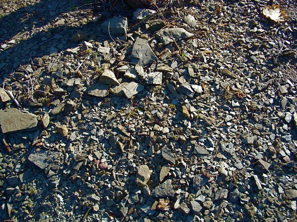
Escarpment:  An escarpment is basically an area of the Earth where the elevation changes suddenly. An escarpment is often found along the ocean shore, such as the Devil’s Slide area of California Highway 1.  An escarpment can also refer to an area on dry land that separates two level land surfaces, such as Africa’s Great Rift Valley and the Niagara Escarpment (only a small portion of which hosts the famous falls.)

A tiny piece of the Niagara Escarpment

A tiny piece of the Niagara Escarpment

An escarpment usually indicates two different types of land, such as the area of a beach where tall cliffs surround a lower area of sand.  Escarpments between two areas of level land are usually composed of different types of rock or rocks from different geologic eras, one of which erodes much faster than the other. Escarpments can also be formed by seismic action; such as when a fault displaces the ground surface so that one side is higher than the other (scary).

Significant Wine-Related Escarpments include the Niagara Escarpment, the Côte d’Or, the Balcones Fault in Central Texas, and the Darling Scarp in Western Australia. The term “scarp” technically refers to just the the cliff-face of an escarpment, but the two terms are generally interchangable.

Bench: Admit it, you’ve talked in hushed tones about the amazing flavor of Cabernet Sauvignon from the Rutherford Bench….but do you know what is meant, geologically, by the term bench?  Neither did I.  Tchnically, a bench or a “benchland” is a long, narrow strip of relatively level land that is bounded by distinctly steeper slopes above and below it. Benches can be formed by many different geological processes, such as a river (as in a river’s flood plain, or an “abandoned” river bed), waves (if alongside an ocean), or the varying levels of erosion of different types of rock.

Cross Section of Different Types of "Bences"

Cross Section of Different Types of “Benches”

Thanks to Wikimedia Commons for the diagram of “Bench Structure.” The diagram shows the different ways benches can form, such as structural benches formed by the  erosion of shale beds overlying limestone beds and the more common “river terraces.”

The famous “Rutherford Bench” is a stretch of the Napa Valley, about three miles long, starting in Oakville and heading north to Rutherford.  The bench sits in the middle of the valley floor, surrounded on two sides by small hills. The famous soil of the Rutherford Bench consists of gravel, loam, and sand, much of which was deposited there by earlier advances and retreats of San Pablo Bay.

The term “bench” appears in the discussion of wine regions (though not necessarily AVAs or appellations) frequently:  the Rutherford Bench and the Oakville Bench were both at one time or another considered for AVAs of their own, but to date have not been designated as such. There are however, five “official” wine regions that I could find that use the term:  Kelsey Bench-Lake County AVA, and four VQAs in Ontario: Short Hills Bench, St. David’s Bench, Beamsville Bench, and Twenty-Mile Bench.

References/for more information:

Deconstructing Llicorella

PrioratThis morning I set about to research the wine region of Priorat for a blog post.  I already knew the basics of the region, such as the fact that it is one of Spain’s two DOCa wines, the main grape variety is Garnacha Tinta, and the area came to international attention in the 1990s.

Wikipedia (I know, not the best reference but in this case, just a starting point) also had this to say, “The area is characterized by its unique terroir of black slate and quartz soil known locally as Llicorella.” I already knew that the soil in Priorat is mainly Llicorella…at least I knew the word, and could have guessed it correctly on a multiple choice test.  But being in a Monday sort of contemplative mood, I wondered if I really understood Llicorella.  Of course, I didn’t. So I set about to deconstruct Llicorella.

First of all…just what exactly is slate? Slate is a fine-grained, foliated, homogeneous metamorphic rock derived from sedimentary rock composed of clay or volcanic ash. It is the finest grained foliated metamorphic rock.

Slate...a Metamorphic Rock

Slate…a Metamorphic Rock

Metamorphic Rock? Metamorphic rocks are created from the transformation of existing rock types.  Metamorphism means “change in form.” Rocks under the earth’s surface change form by being subjected to heat, generally temperatures from 300° – 400°F, which can cause both physical and chemical changes in the rock itself.

Sedimentary Rock? Sedimentary rocks are formed by the solution of mineral and organic particles within bodies of water. Sedimentation is the name for several different processes that cause mineral particles and organic particles to settle and accumulate first into a dissolved solution and later into sediment.  Sediment is then transported to dry land by water, wind, or glaciers, or is left behind when the bodies of water dry up.  With time, the slushy sediment hardens into rock. Sandstone is probably the most well-known sedimentary rock.

Clay? Clay is a very fine-grained soil type made up of very fine minerals such as aluminium phyllosilicates, iron, magnesium, and a bunch of other chemicals I have never heard of. The minerals that make up clay soil are the result of weathering…the breakdown of rocks, soils, and minerals through contact with air, water, and living creatures.

Licorella

Llicorella

Volcanic Ash? Volcanic ash is made up of pieces of pulverized rock, minerals, and volcanic glass that are created during volcanic eruptions. Pieces of ash must be less than 2 mm in diameter – larger fragments are referred to as cinders or blocks. At least this one I can understand!

Foliated? There are two types of metamorphic rocks:  foliated rocks and non-foliated rocks.  Foliated metamorphic rocks, such as schist and slate, have a “layered” appearance that has been produced by exposure to heat and directed pressure.  Non-foliated metamorphic rocks such as marble and quartz do not have the “layered” appearance.

And what is quartz? Quartz is the second most abundant mineral in the Earth’s continental crust, after feldspar. There are many different varieties of quartz, several of which are semi-precious gemstones. Quartz is the most common element of sand and sandstone and is used in glassmaking.  Quartz is almost immune to weathering and is a component of granite and other igneous rocks.

Aha- that’s why sand is coarse (quartz doesn’t “weather”) and clay is fine (its made up of materials that do weather or “breakdown”).

I think I’ll stop there. But for those of you who are curious, igneous rocks are rocks that are formed by the cooling and solidification of lava or magma. Granite and obsidian are igneous rocks.

So now, when someone says, “Llicorella is a unique soil made up of black slate and quartz,” what do you know?

Vineyard in PrioratSources (in addition to http://en.wikipedia.org/wiki/Priorat_(DOQ)):

http://geology.com/

http://www.quartzpage.de/index.html

http://www.mineralszone.com/

http://www.turismepriorat.org/en

http://www.in-spain.info/top20/spanish-white-wine-priorat.htm

The Bubbly Professor is “Miss Jane” Nickles of Austin, Texas  missjane@prodigy.net